Area Overview for BS39 5XY
Photos of BS39 5XY

Area Information
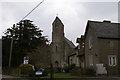
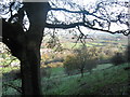
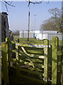
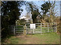
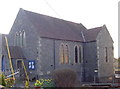
BS39 5XY lies within the Stowey-Sutton civil parish in Somerset, a rural area blending historical charm with modern convenience. The postcode covers a small residential cluster with a population of 1,623 and a density of 209 people per square kilometre. This area is part of the Chew Valley, a region known for its natural beauty and low population density. Stowey-Sutton itself combines the small village of Stowey, with a population of around 100, and the larger village of Bishop Sutton. The area is rich in flora and fauna, with sites of Nature Conservation Interest and ancient woodlands like Strawberry Woods. Its proximity to Bath—approximately 10 miles north—offers easy access to cultural and commercial hubs, while the A368 road provides connectivity to nearby towns. Residents benefit from a tranquil rural setting, with historical landmarks such as Sutton Court, a Grade II* listed building, and the Church of St Nicholas and St Mary. Daily life here is shaped by a close-knit community, local amenities, and a strong sense of heritage.
- Area Type
- Postcode
- Area Size
- Not available
- Population
- 1623
- Population Density
- 209 people/km²
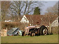
The property market in BS39 5XY is dominated by owner-occupied homes, with 82% of properties owned by residents rather than rented. The accommodation type is primarily houses, which is typical for rural and semi-rural areas. This suggests a market geared toward families and individuals seeking long-term residency rather than short-term investment. The high home ownership rate indicates a stable community with limited turnover, which can be appealing to buyers seeking security and a sense of permanence. The small size of the area means properties are likely to be in close proximity to local amenities, schools, and natural spaces. For buyers, this environment offers a blend of traditional housing stock and a low-pressure market, though the limited number of properties may mean competition for available homes.
House Prices in BS39 5XY
No properties found in this postcode.
Energy Efficiency in BS39 5XY
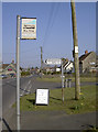
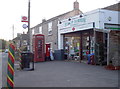
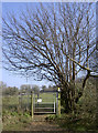
The lifestyle in BS39 5XY is shaped by its rural setting and nearby amenities. Within practical reach are five retail venues, including Spar Wick, The Radstock Co-operative Society Co, and other local shops, providing essential services for daily needs. The area’s natural surroundings, such as unimproved grasslands, flowery meadows, and ancient woodlands, offer opportunities for outdoor activities and leisure. While specific parks or recreational facilities are not listed in the data, the presence of nature reserves like Folly Farm (managed by the Avon Wildlife Trust) suggests access to green spaces for walking or wildlife observation. The combination of local shops and natural landscapes creates a convenient, self-sufficient lifestyle, ideal for those who value tranquillity alongside practical amenities.
Amenities
Schools
The nearest school to BS39 5XY is Bishop Sutton Primary School, a primary school with an Ofsted rating of ‘good’. This school serves the local community, providing education for younger children in the area. The presence of a primary school within practical reach is a significant factor for families, reducing the need for long commutes to larger towns. While no secondary schools are listed in the data, the proximity of Bishop Sutton Primary School suggests that families may rely on nearby towns like Bath or Radstock for secondary education. The ‘good’ Ofsted rating indicates a school that meets quality standards, offering a reliable foundation for early education. This makes BS39 5XY an attractive option for families prioritising accessible schooling.
| Rank | School | Type | Entry gender | Ages |
|---|
Explore more schools in this area
Go to Schools tabDemographics
The population of BS39 5XY has a median age of 47, with the majority of residents aged between 30 and 64 years. This suggests a community skewed toward middle-aged adults, likely including families and professionals. Home ownership is high at 82%, indicating a stable, long-term resident base. The predominant accommodation type is houses, reflecting a suburban or semi-rural character rather than high-density housing. The predominant ethnic group is White, which aligns with the broader demographic trends in rural Somerset. The absence of specific data on deprivation or diversity means the area’s social fabric remains largely defined by its age profile and ownership patterns. This demographic structure implies a community focused on stability, with fewer transient residents and a strong emphasis on family-oriented living.
Household Size
Accommodation Type
Tenure
Ethnic Group
Religion
Household Composition
Age
Household Deprivation
NS-SEC
Explore more demographic insights in this area
Go to Demographics tabPlanning
Planning Constraints
- Flood RiskPremium
- Ramsar Wetland SitesPremium
- Area of Outstanding Natural BeautyPremium
- Protected Nature ReservePremium
- Protected WoodlandPremium