Area Overview for BS39 5XD
Photos of BS39 5XD
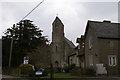
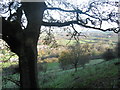
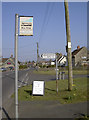
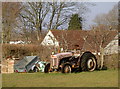
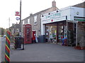
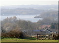
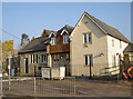
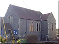
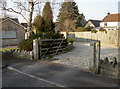
74 photos from this area
Area Information
Key information about the BS39 5XD including its size, population, and administrative classification.
- Area Type
- Postcode
- Area Size
- 3.4 hectares
- Population
- 1623
- Population Density
- 209 people/km²
House Prices in BS39 5XD
25
Properties
£411,795
Average Sold Price
£92,000
Lowest Price
£630,000
Highest Price
Showing 25 properties
| Address | Type | Beds | Baths | Last Sale Price | Last Sale Date | |
|---|---|---|---|---|---|---|
| Ashleigh, Wick Road, Bishop Sutton, Bristol, BS39 5XD | Detached | 2 | 1 | £396,000 | Aug 2023 | |
| Haydens, Wick Road, Bishop Sutton, Bristol, BS39 5XD | Bungalow | - | - | £375,000 | Jun 2021 | |
| Shadow Way Cottage, Wick Road, Bishop Sutton, Bristol, BS39 5XD | Detached | 4 | 2 | £420,000 | Mar 2021 | |
| Rowan Barn, Wick Road, Bishop Sutton, Bristol, BS39 5XD | Detached | 4 | 2 | £630,000 | Aug 2019 | |
| Littlewell House, Wick Road, Bishop Sutton, Bristol, BS39 5XD | Detached | 4 | 2 | £610,000 | Jul 2018 | |
| New House, Wick Road, Bishop Sutton, Bristol, BS39 5XD | Detached | 4 | - | £360,000 | Apr 2015 | |
| Homefields, Wick Road, Bishop Sutton, Bristol, BS39 5XD | house | 3 | 1 | £359,950 | Jan 2015 | |
| Parkfield, Wick Road, Bishop Sutton, Bristol, BS39 5XD | Detached | 4 | 3 | £420,000 | Aug 2013 | |
| Mountain Ash Farm, Wick Road, Bishop Sutton, Bristol, BS39 5XD | house | 5 | 3 | £455,000 | Sep 2012 | |
| Stones Throw, Wick Road, Bishop Sutton, Bristol, BS39 5XD | Semi-detached | - | - | £92,000 | Feb 1998 |
Page 1 of 3
Energy Efficiency in BS39 5XD
Amenities
Schools
| Rank | School | Type | Entry gender | Ages |
|---|
Explore more schools in this area
Go to Schools tabDemographics
Household Size
Family (3-5 people)
most common
Accommodation Type
Houses
most common
Tenure
82
majority
Ethnic Group
White
most common
Religion
N/A
most common
Household Composition
N/A
most common
Age
47
median
Adults (30-64 years)
most common
Household Deprivation
N/A
with no deprivation
NS-SEC
45
in Lower managerial occupations
Explore more demographic insights in this area
Go to Demographics tabPlanning
Planning Constraints
- Flood RiskPremium
- Ramsar Wetland SitesPremium
- Area of Outstanding Natural BeautyPremium
- Protected Nature ReservePremium
- Protected WoodlandPremium