Area Overview for BS39 5PG
Photos of BS39 5PG
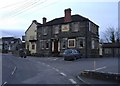
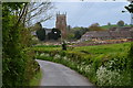
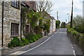
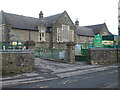
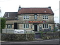
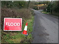
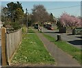
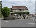
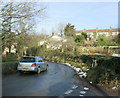
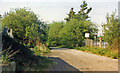
21 photos from this area
Area Information
Key information about the BS39 5PG including its size, population, and administrative classification.
- Area Type
- Postcode
- Area Size
- 6.7 hectares
- Population
- 1461
- Population Density
- 92 people/km²
House Prices in BS39 5PG
16
Properties
£276,850
Average Sold Price
£265,000
Lowest Price
£288,700
Highest Price
Showing 16 properties
| Address | Type | Beds | Baths | Last Sale Price | Last Sale Date | |
|---|---|---|---|---|---|---|
| 146 Greensbrook, Clutton, Bristol, BS39 5PG | house | - | - | £265,000 | Jun 2018 | |
| 140 Greensbrook, Clutton, Bristol, BS39 5PG | house | 4 | 1 | £288,700 | Oct 2009 | |
| Primrose Valley, 4 Greensbrook, Clutton, Bristol, BS39 5PG | Bungalow | 3 | - | - | - | |
| Muratie House, Greensbrook, Clutton, Bristol, BS39 5PG | house | - | - | - | - | |
| Clovelly House, Greensbrook, Clutton, Bristol, BS39 5PG | house | - | - | - | - | |
| The Cottage, Greensbrook, Clutton, Bristol, BS39 5PG | house | - | - | - | - | |
| Churchlands, Greensbrook, Clutton, Bristol, BS39 5PG | house | - | - | - | - | |
| Churchlands Bungalow, Greensbrook, Clutton, Bristol, BS39 5PG | house | - | - | - | - | |
| 147 Greensbrook, Clutton, Bristol, BS39 5PG | Terraced | - | - | - | - | |
| Birch Tree Cottage, 145 Greensbrook, Clutton, Bristol, BS39 5PG | house | - | - | - | - |
Page 1 of 2
Energy Efficiency in BS39 5PG
Amenities
Schools
| Rank | School | Type | Entry gender | Ages |
|---|
Explore more schools in this area
Go to Schools tabDemographics
Household Size
Two person
most common
Accommodation Type
Houses
most common
Tenure
79
majority
Ethnic Group
White
most common
Religion
N/A
most common
Household Composition
N/A
most common
Age
47
median
Adults (30-64 years)
most common
Household Deprivation
N/A
with no deprivation
NS-SEC
41
in Lower managerial occupations
Explore more demographic insights in this area
Go to Demographics tabPlanning
Planning Constraints
- Flood RiskPremium
- Ramsar Wetland SitesPremium
- Area of Outstanding Natural BeautyPremium
- Protected Nature ReservePremium
- Protected WoodlandPremium