Area Overview for BS39 5AN
Photos of BS39 5AN
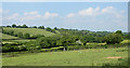
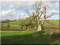
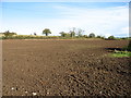
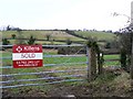
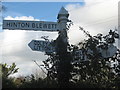
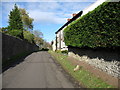
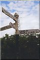

12 photos from this area
Area Information
Key information about the BS39 5AN including its size, population, and administrative classification.
- Area Type
- Postcode
- Area Size
- 4.7 hectares
- Population
- 1484
- Population Density
- 79 people/km²
House Prices in BS39 5AN
8
Properties
£815,000
Average Sold Price
£280,000
Lowest Price
£1,350,000
Highest Price
Showing 8 properties
| Address | Type | Beds | Baths | Last Sale Price | Last Sale Date | |
|---|---|---|---|---|---|---|
| The Old Rectory, Upper Road, Hinton Blewett, Bristol, BS39 5AN | Detached | 6 | 5 | £1,350,000 | Jan 2020 | |
| Abbots Barn Farm, Lower Road, Hinton Blewett, Bristol, BS39 5AN | Detached | - | - | £280,000 | Jun 1995 | |
| Manor House, Upper Road, Hinton Blewett, Bristol, BS39 5AN | Detached | 6 | 4 | - | - | |
| Origin Interiors Limited, The Stable Yard, Manor House, Upper Road, Hinton Blewett, Bristol, BS39 5AN | Industrial | - | - | - | - | |
| Unregistered Flat, The Old Rectory, Upper Road, Hinton Blewett, Bristol, BS39 5AN | Flat | - | - | - | - | |
| Manor House Cottage, Upper Road, Hinton Blewett, Bristol, BS39 5AN | Terraced | 3 | - | - | - | |
| Church Cottage, Upper Road, Hinton Blewett, Bristol, BS39 5AN | Terraced | - | - | - | - | |
| Ring O'bells, Upper Road, Hinton Blewett, Bristol, BS39 5AN | hotel | - | - | - | - |
Energy Efficiency in BS39 5AN
Amenities
Schools
| Rank | School | Type | Entry gender | Ages |
|---|
Explore more schools in this area
Go to Schools tabDemographics
Household Size
Two person
most common
Accommodation Type
Houses
most common
Tenure
80
majority
Ethnic Group
White
most common
Religion
N/A
most common
Household Composition
N/A
most common
Age
47
median
Adults (30-64 years)
most common
Household Deprivation
N/A
with no deprivation
NS-SEC
48
in Lower managerial occupations
Explore more demographic insights in this area
Go to Demographics tabPlanning
Planning Constraints
- Flood RiskPremium
- Ramsar Wetland SitesPremium
- Area of Outstanding Natural BeautyPremium
- Protected Nature ReservePremium
- Protected WoodlandPremium