Area Overview for BS37 8UX
Photos of BS37 8UX

29 photos from this area
Area Information
Key information about the BS37 8UX including its size, population, and administrative classification.
- Area Type
- Postcode
- Area Size
- 1.0 hectares
- Population
- 1300
- Population Density
- 4024 people/km²
House Prices in BS37 8UX
33
Properties
£177,798
Average Sold Price
£59,950
Lowest Price
£275,000
Highest Price
Showing 33 properties
| Address | Type | Beds | Baths | Last Sale Price | Last Sale Date | |
|---|---|---|---|---|---|---|
| 71 Cherington, Yate, BS37 8UX | Terraced | 3 | 1 | £272,500 | Apr 2025 | |
| 93 Cherington, Yate, BS37 8UX | Terraced | 3 | 1 | £230,000 | Nov 2024 | |
| 75 Cherington, Yate, BS37 8UX | Semi-detached | 3 | 1 | £275,000 | Oct 2024 | |
| 67 Cherington, Yate, BS37 8UX | Terraced | 3 | 1 | £250,000 | Aug 2023 | |
| 95 Cherington, Yate, BS37 8UX | Terraced | 3 | - | £242,500 | Dec 2020 | |
| 85 Cherington, Yate, BS37 8UX | Semi-detached | 3 | 1 | £217,000 | Oct 2018 | |
| 68 Cherington, Yate, BS37 8UX | Terraced | 3 | 1 | £214,000 | Sep 2018 | |
| 88 Cherington, Yate, BS37 8UX | Terraced | 3 | - | £200,000 | Feb 2018 | |
| 66 Cherington, Yate, BS37 8UX | Terraced | 3 | 1 | £210,000 | Oct 2017 | |
| 79 Cherington, Yate, BS37 8UX | Terraced | 3 | - | £215,000 | Aug 2017 |
Page 1 of 4
Energy Efficiency in BS37 8UX
Amenities
Schools
| Rank | School | Type | Entry gender | Ages |
|---|
Explore more schools in this area
Go to Schools tabDemographics
Household Size
Family (3-5 people)
most common
Accommodation Type
Houses
most common
Tenure
82
majority
Ethnic Group
White
most common
Religion
N/A
most common
Household Composition
N/A
most common
Age
47
median
Adults (30-64 years)
most common
Household Deprivation
N/A
with no deprivation
NS-SEC
27
in Lower managerial occupations
Explore more demographic insights in this area
Go to Demographics tabPlanning
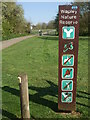
Planning Constraints
- Flood RiskPremium
- Ramsar Wetland SitesPremium
- Area of Outstanding Natural BeautyPremium
- Protected Nature ReservePremium
- Protected WoodlandPremium