Area Overview for BS37 8TE
Photos of BS37 8TE
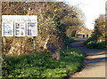
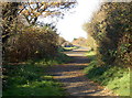
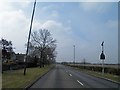
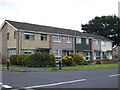
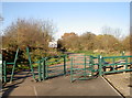
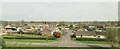
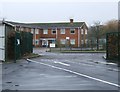
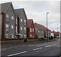
14 photos from this area
Area Information
Key information about the BS37 8TE including its size, population, and administrative classification.
- Area Type
- Postcode
- Area Size
- 1.5 hectares
- Population
- 1795
- Population Density
- 5253 people/km²
House Prices in BS37 8TE
29
Properties
£179,193
Average Sold Price
£40,000
Lowest Price
£320,000
Highest Price
Showing 29 properties
| Address | Type | Beds | Baths | Last Sale Price | Last Sale Date | |
|---|---|---|---|---|---|---|
| 119 Bredon, Yate, BS37 8TE | Terraced | 3 | 1 | £275,000 | Jul 2025 | |
| 122 Bredon, Yate, BS37 8TE | Terraced | 3 | 1 | £270,000 | Feb 2024 | |
| 107 Bredon, Yate, BS37 8TE | Terraced | 3 | 1 | £320,000 | Dec 2023 | |
| 100 Bredon, Yate, BS37 8TE | house | - | - | £275,000 | Jul 2022 | |
| 118 Bredon, Yate, BS37 8TE | Terraced | 3 | - | £250,000 | Sep 2021 | |
| 104 Bredon, Yate, BS37 8TE | Terraced | 3 | - | £258,000 | Jul 2021 | |
| 97 Bredon, Yate, BS37 8TE | Flat | - | - | £142,000 | May 2021 | |
| 114 Bredon, Yate, BS37 8TE | house | - | - | £205,000 | Dec 2020 | |
| 105 Bredon, Yate, BS37 8TE | Terraced | 3 | 1 | £235,000 | Aug 2020 | |
| 123 Bredon, Yate, BS37 8TE | house | - | - | £230,000 | Aug 2019 |
Page 1 of 3
Energy Efficiency in BS37 8TE
Amenities
Schools
| Rank | School | Type | Entry gender | Ages |
|---|
Explore more schools in this area
Go to Schools tabDemographics
Household Size
Family (3-5 people)
most common
Accommodation Type
Houses
most common
Tenure
64
majority
Ethnic Group
White
most common
Religion
N/A
most common
Household Composition
N/A
most common
Age
47
median
Adults (30-64 years)
most common
Household Deprivation
N/A
with no deprivation
NS-SEC
25
in Lower managerial occupations
Explore more demographic insights in this area
Go to Demographics tabPlanning
Planning Constraints
- Flood RiskPremium
- Ramsar Wetland SitesPremium
- Area of Outstanding Natural BeautyPremium
- Protected Nature ReservePremium
- Protected WoodlandPremium