Area Overview for BS37 7QW
Photos of BS37 7QW
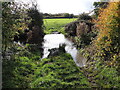
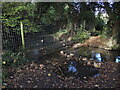
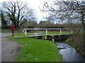
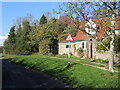
17 photos from this area
Area Information
Key information about the BS37 7QW including its size, population, and administrative classification.
- Area Type
- Postcode
- Area Size
- 1.8 hectares
- Population
- 2999
- Population Density
- 924 people/km²
House Prices in BS37 7QW
29
Properties
£320,540
Average Sold Price
£74,500
Lowest Price
£525,000
Highest Price
Showing 29 properties
| Address | Type | Beds | Baths | Last Sale Price | Last Sale Date | |
|---|---|---|---|---|---|---|
| 8 The Brake, Yate, BS37 7QW | house | - | - | £405,000 | Mar 2025 | |
| 1 The Brake, Yate, BS37 7QW | Detached | 4 | 2 | £500,000 | Oct 2024 | |
| 13 The Brake, Yate, BS37 7QW | Detached | 3 | 3 | £441,000 | Sep 2022 | |
| 2 The Brake, Yate, BS37 7QW | Detached | 4 | - | £395,000 | May 2021 | |
| 12 The Brake, Yate, BS37 7QW | Detached | 5 | 3 | £525,000 | Dec 2020 | |
| 15 The Brake, Yate, BS37 7QW | house | - | - | £360,000 | Nov 2020 | |
| 26 The Brake, Yate, BS37 7QW | Detached | 4 | - | £490,000 | Dec 2019 | |
| 28 The Brake, Yate, BS37 7QW | Detached | 4 | 2 | £420,000 | Dec 2017 | |
| 17 The Brake, Yate, BS37 7QW | Detached | 5 | 1 | £385,000 | Jul 2017 | |
| 25 The Brake, Yate, BS37 7QW | house | - | - | £303,000 | Oct 2016 |
Page 1 of 3
Energy Efficiency in BS37 7QW
Amenities
Schools
| Rank | School | Type | Entry gender | Ages |
|---|
Explore more schools in this area
Go to Schools tabDemographics
Household Size
Family (3-5 people)
most common
Accommodation Type
Houses
most common
Tenure
80
majority
Ethnic Group
White
most common
Religion
N/A
most common
Household Composition
N/A
most common
Age
47
median
Adults (30-64 years)
most common
Household Deprivation
N/A
with no deprivation
NS-SEC
43
in Lower managerial occupations
Explore more demographic insights in this area
Go to Demographics tabPlanning
Planning Constraints
- Flood RiskPremium
- Ramsar Wetland SitesPremium
- Area of Outstanding Natural BeautyPremium
- Protected Nature ReservePremium
- Protected WoodlandPremium