Area Overview for BS37 7PS
Photos of BS37 7PS
Area Information
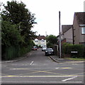
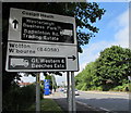
Living in BS37 7PS, a small postcode area in South Gloucestershire, offers a blend of rural tranquillity and practical connectivity. The area covers 2,811 square metres and is home to 1,939 residents, making it a low-density, spread-out community. Nestled in the civil parish of Westerleigh and Coalpit Heath, it lies just 1 mile south of Yate and 10 miles northeast of Bristol. Historically shaped by coal mining, the area now features a mix of traditional villages like Westerleigh and Coalpit Heath, along with hamlets such as Henfield and Nibley. Residents benefit from proximity to the M4 motorway and multiple railway stations, including Yate and Bristol Parkway, while the Frome Valley Walkway offers scenic routes. The area’s character is defined by its modest scale, historic churches like St James the Great, and a quiet, community-focused lifestyle. For those seeking a peaceful yet accessible location, BS37 7PS balances rural charm with modern convenience.
- Area Type
- Postcode
- Area Size
- 2811 m²
- Population
- 1939
- Population Density
- 133 people/km²
BS37 7PS is predominantly an owner-occupied area, with 81% of homes owned by residents rather than rented. The accommodation type is largely houses, which is typical for rural or semi-rural postcodes. This suggests a market focused on single-family homes rather than flats or apartments, appealing to those prioritising space and privacy. Given the area’s small size and limited housing stock, buyers may need to consider nearby areas for more options. The high home ownership rate indicates a stable, long-term resident base, which can be a positive sign for property value retention. However, the modest population size means the market is not highly competitive, potentially offering opportunities for those seeking traditional homes in a low-density setting.
House Prices in BS37 7PS
No properties found in this postcode.
Energy Efficiency in BS37 7PS
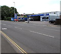
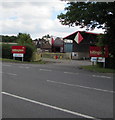
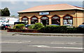
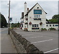
Residents of BS37 7PS enjoy a range of amenities within reach, including retail outlets like Morrisons and Tesco, and railway stations that connect to broader transport networks. The area’s historic charm is complemented by recreational spaces such as Bitterwell Lake at Henfield and the 27-hole Kendleshire Golf Club. Public houses, a post office, and a primary school contribute to a community-focused lifestyle. The Frome Valley Walkway offers scenic walks, while Coalpit Heath Cricket Club provides local sports facilities. The mix of traditional village amenities and practical retail options ensures daily life is both convenient and rooted in the area’s heritage. Though modest in scale, the amenities reflect a balance between rural simplicity and essential modern conveniences.
Amenities
Schools
Near BS37 7PS are two schools: Vinney Green Secure Unit, which is classified as “other,” and Immanuel Christian School, an independent institution with a “good” Ofsted rating. The presence of an independent school may attract families seeking alternative education options, while the secure unit likely serves specific needs. The mix of school types reflects a diverse educational landscape, though the area lacks state-funded secondary schools. Parents should consider the limited range of school choices when evaluating the area. For families prioritising independent education, Immanuel Christian School’s good rating is a notable advantage. However, those requiring state-funded schooling may need to look further afield, as the immediate vicinity offers only a narrow selection.
| Rank | School | Type | Entry gender | Ages |
|---|
Explore more schools in this area
Go to Schools tabDemographics
The population of BS37 7PS is 1,939, with a density of 133 people per square kilometre, indicating a low-density, spread-out settlement. The median age is 47, with the majority of residents aged 30–64, reflecting a mature, working-age population. Home ownership is high at 81%, and the predominant accommodation type is houses, suggesting a stable, family-oriented community. The predominant ethnic group is White, aligning with broader regional demographics. This age profile and ownership pattern imply a settled population with long-term ties to the area. The lower population density may mean fewer social amenities per capita, but the community’s small size fosters a close-knit environment. For prospective buyers, this suggests a market skewed towards owner-occupiers seeking traditional housing rather than rental properties.
Household Size
Accommodation Type
Tenure
Ethnic Group
Religion
Household Composition
Age
Household Deprivation
NS-SEC
Explore more demographic insights in this area
Go to Demographics tabPlanning
Planning Constraints
- Flood RiskPremium
- Ramsar Wetland SitesPremium
- Area of Outstanding Natural BeautyPremium
- Protected Nature ReservePremium
- Protected WoodlandPremium