Area Overview for BS37 7LQ
Photos of BS37 7LQ

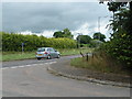

18 photos from this area
Area Information
Key information about the BS37 7LQ including its size, population, and administrative classification.
- Area Type
- Postcode
- Area Size
- 3.0 hectares
- Population
- 2262
- Population Density
- 113 people/km²
House Prices in BS37 7LQ
29
Properties
£465,500
Average Sold Price
£295,000
Lowest Price
£910,000
Highest Price
Showing 29 properties
| Address | Type | Beds | Baths | Last Sale Price | Last Sale Date | |
|---|---|---|---|---|---|---|
| 274 North Road, Yate, BS37 7LQ | Semi-detached | 3 | 2 | £378,000 | Apr 2023 | |
| Dragons Lair, 260 North Road, Yate, BS37 7LQ | Detached | 4 | - | £465,000 | Sep 2021 | |
| Coronation Cottage, 276 North Road, Yate, BS37 7LQ | Detached | 4 | 3 | £910,000 | Jul 2021 | |
| 248 North Road, Yate, BS37 7LQ | Semi-detached | 4 | - | £345,000 | Aug 2020 | |
| Chelston House, 258 North Road, Yate, BS37 7LQ | Detached | 4 | 2 | £400,000 | Aug 2017 | |
| The Old Chapel, North Road, Yate, BS37 7LQ | Detached | 4 | 2 | £295,000 | Nov 2006 | |
| Flat 3, North Road Stores, 218 North Road, Yate, BS37 7LQ | Flat | 4 | 2 | - | - | |
| 204 North Road, Yate, BS37 7LQ | Detached | 6 | - | - | - | |
| Flat 1, North Road Stores, 218 North Road, Yate, BS37 7LQ | Land | - | - | - | - | |
| 242 North Road, Yate, BS37 7LQ | Semi-detached | - | - | - | - |
Page 1 of 3
Energy Efficiency in BS37 7LQ
Amenities
Schools
| Rank | School | Type | Entry gender | Ages |
|---|
Explore more schools in this area
Go to Schools tabDemographics
Household Size
Two person
most common
Accommodation Type
Houses
most common
Tenure
80
majority
Ethnic Group
White
most common
Religion
N/A
most common
Household Composition
N/A
most common
Age
47
median
Adults (30-64 years)
most common
Household Deprivation
N/A
with no deprivation
NS-SEC
39
in Lower managerial occupations
Explore more demographic insights in this area
Go to Demographics tabPlanning
Planning Constraints
- Flood RiskPremium
- Ramsar Wetland SitesPremium
- Area of Outstanding Natural BeautyPremium
- Protected Nature ReservePremium
- Protected WoodlandPremium