Area Overview for BS37 6LH
Photos of BS37 6LH
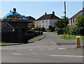
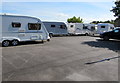
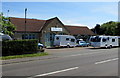
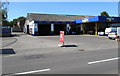
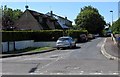
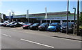
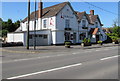
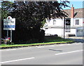
60 photos from this area
Area Information
Key information about the BS37 6LH including its size, population, and administrative classification.
- Area Type
- Postcode
- Area Size
- 3.9 hectares
- Population
- Not available
- Population Density
- Not available
House Prices in BS37 6LH
6
Properties
£399,100
Average Sold Price
£270,500
Lowest Price
£550,000
Highest Price
Showing 6 properties
| Address | Type | Beds | Baths | Last Sale Price | Last Sale Date | |
|---|---|---|---|---|---|---|
| Redwood House, Badminton Road, Chipping Sodbury, BS37 6LH | Detached | 3 | - | £550,000 | Mar 2021 | |
| Valschena, Badminton Road, Chipping Sodbury, BS37 6LH | Bungalow | - | - | £400,000 | Dec 2020 | |
| Box Hedge Bungalow, Badminton Road, Chipping Sodbury, BS37 6LH | Bungalow | 1 | - | £270,500 | Nov 2020 | |
| Box Hedge Villa, Badminton Road, Chipping Sodbury, BS37 6LH | Terraced | 4 | - | £460,000 | Sep 2014 | |
| Allermuir, Badminton Road, Chipping Sodbury, BS37 6LH | Bungalow | 3 | - | £315,000 | Feb 2014 | |
| Blanchards Farm, Badminton Road, Chipping Sodbury, BS37 6LH | Terraced | - | - | - | - |
Energy Efficiency in BS37 6LH
Amenities
Schools
| Rank | School | Type | Entry gender | Ages |
|---|
Explore more schools in this area
Go to Schools tabDemographics
Household Size
Two person
most common
Accommodation Type
Houses
most common
Tenure
88
majority
Ethnic Group
White
most common
Religion
N/A
most common
Household Composition
N/A
most common
Age
47
median
Adults (30-64 years)
most common
Household Deprivation
N/A
with no deprivation
NS-SEC
48
in Lower managerial occupations
Explore more demographic insights in this area
Go to Demographics tabPlanning
Planning Constraints
- Flood RiskPremium
- Ramsar Wetland SitesPremium
- Area of Outstanding Natural BeautyPremium
- Protected Nature ReservePremium
- Protected WoodlandPremium