Area Overview for BS37 6BA
Photos of BS37 6BA
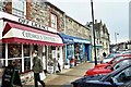
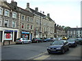
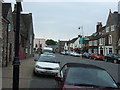
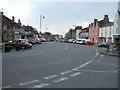
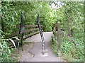
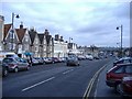
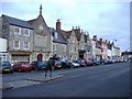
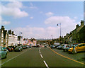
100 photos from this area
Area Information
Key information about the BS37 6BA including its size, population, and administrative classification.
- Area Type
- Postcode
- Area Size
- 1.8 hectares
- Population
- Not available
- Population Density
- Not available
House Prices in BS37 6BA
33
Properties
£417,900
Average Sold Price
£130,000
Lowest Price
£722,500
Highest Price
Showing 33 properties
| Address | Type | Beds | Baths | Last Sale Price | Last Sale Date | |
|---|---|---|---|---|---|---|
| Westgate House, 3 High Street, Chipping Sodbury, BS37 6BA | Retail | 4 | 3 | £722,500 | Sep 2022 | |
| 21 High Street, Chipping Sodbury, BS37 6BA | house | 5 | - | £500,000 | Feb 2017 | |
| 15 High Street, Chipping Sodbury, BS37 6BA | house | - | - | £445,000 | Oct 2010 | |
| 19 High Street, Chipping Sodbury, BS37 6BA | Terraced | - | - | £292,000 | Apr 2000 | |
| 5 High Street, Chipping Sodbury, BS37 6BA | Flat | - | - | £130,000 | Apr 1996 | |
| 37A High Street, Chipping Sodbury, BS37 6BA | Terraced | 1 | 1 | - | - | |
| 11 High Street, Chipping Sodbury, BS37 6BA | Terraced | - | - | - | - | |
| 17 High Street, Chipping Sodbury, BS37 6BA | Terraced | - | - | - | - | |
| The Old Blacksmiths Loft, 37C High Street, Chipping Sodbury, BS37 6BA | Flat | - | - | - | - | |
| The Wool Cellar, Hatherells Yard, High Street, Chipping Sodbury, BS37 6BA | shop | - | - | - | - |
Page 1 of 4
Energy Efficiency in BS37 6BA
Amenities
Schools
| Rank | School | Type | Entry gender | Ages |
|---|
Explore more schools in this area
Go to Schools tabDemographics
Household Size
One person
most common
Accommodation Type
Houses
most common
Tenure
62
majority
Ethnic Group
White
most common
Religion
N/A
most common
Household Composition
N/A
most common
Age
47
median
Adults (30-64 years)
most common
Household Deprivation
N/A
with no deprivation
NS-SEC
31
in Lower managerial occupations
Explore more demographic insights in this area
Go to Demographics tabPlanning
Planning Constraints
- Flood RiskPremium
- Ramsar Wetland SitesPremium
- Area of Outstanding Natural BeautyPremium
- Protected Nature ReservePremium
- Protected WoodlandPremium