Area Overview for BS37 4ND
Photos of BS37 4ND


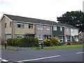


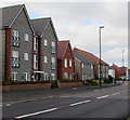
14 photos from this area
Area Information
Key information about the BS37 4ND including its size, population, and administrative classification.
- Area Type
- Postcode
- Area Size
- 1.3 hectares
- Population
- 1321
- Population Density
- 7707 people/km²
House Prices in BS37 4ND
39
Properties
£162,102
Average Sold Price
£57,950
Lowest Price
£270,000
Highest Price
Showing 39 properties
| Address | Type | Beds | Baths | Last Sale Price | Last Sale Date | |
|---|---|---|---|---|---|---|
| 173 Glenfall, Yate, BS37 4ND | Terraced | 3 | 1 | £270,000 | May 2024 | |
| 158 Glenfall, Yate, BS37 4ND | Terraced | 3 | 1 | £253,000 | Nov 2023 | |
| 171 Glenfall, Yate, BS37 4ND | Terraced | 3 | 1 | £245,000 | Mar 2023 | |
| 193A Glenfall, Yate, BS37 4ND | Terraced | 1 | - | £155,000 | Nov 2021 | |
| 187 Glenfall, Yate, BS37 4ND | house | - | - | £245,000 | Nov 2021 | |
| 160 Glenfall, Yate, BS37 4ND | Terraced | 3 | 1 | £235,000 | Aug 2021 | |
| 172 Glenfall, Yate, BS37 4ND | Terraced | 3 | 1 | £244,000 | Nov 2020 | |
| 192 Glenfall, Yate, BS37 4ND | Terraced | - | - | £185,000 | Dec 2019 | |
| 193 Glenfall, Yate, BS37 4ND | Flat | - | - | £134,000 | Mar 2019 | |
| 184 Glenfall, Yate, BS37 4ND | Terraced | 3 | - | £205,000 | Apr 2018 |
Page 1 of 4
Energy Efficiency in BS37 4ND
Amenities
Schools
| Rank | School | Type | Entry gender | Ages |
|---|
Explore more schools in this area
Go to Schools tabDemographics
Household Size
Family (3-5 people)
most common
Accommodation Type
Houses
most common
Tenure
82
majority
Ethnic Group
White
most common
Religion
N/A
most common
Household Composition
N/A
most common
Age
47
median
Adults (30-64 years)
most common
Household Deprivation
N/A
with no deprivation
NS-SEC
27
in Lower managerial occupations
Explore more demographic insights in this area
Go to Demographics tabPlanning
Planning Constraints
- Flood RiskPremium
- Ramsar Wetland SitesPremium
- Area of Outstanding Natural BeautyPremium
- Protected Nature ReservePremium
- Protected WoodlandPremium