Area Overview for BS37 4JQ
Photos of BS37 4JQ

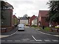

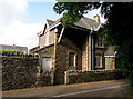


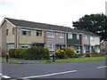
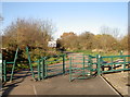

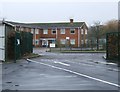
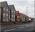
14 photos from this area
Area Information
Key information about the BS37 4JQ including its size, population, and administrative classification.
- Area Type
- Postcode
- Area Size
- 1.1 hectares
- Population
- 1369
- Population Density
- 2672 people/km²
House Prices in BS37 4JQ
39
Properties
£151,198
Average Sold Price
£43,000
Lowest Price
£260,000
Highest Price
Showing 39 properties
| Address | Type | Beds | Baths | Last Sale Price | Last Sale Date | |
|---|---|---|---|---|---|---|
| 14 Sandhurst, Yate, BS37 4JQ | house | - | - | £239,000 | Jan 2025 | |
| 16 Sandhurst, Yate, BS37 4JQ | Terraced | 3 | 1 | £220,000 | May 2024 | |
| 35 Sandhurst, Yate, BS37 4JQ | Terraced | 3 | 1 | £260,000 | May 2023 | |
| 34 Sandhurst, Yate, BS37 4JQ | house | - | - | £238,000 | Feb 2022 | |
| 3 Sandhurst, Yate, BS37 4JQ | Terraced | 4 | 1 | £248,000 | Mar 2019 | |
| 13 Sandhurst, Yate, BS37 4JQ | Terraced | 3 | 1 | £225,000 | Jul 2017 | |
| 11 Sandhurst, Yate, BS37 4JQ | Terraced | 3 | 1 | £178,000 | May 2017 | |
| 9 Sandhurst, Yate, BS37 4JQ | Terraced | 3 | - | £182,000 | Jun 2016 | |
| 4 Sandhurst, Yate, BS37 4JQ | Terraced | 3 | - | £210,000 | Apr 2016 | |
| 22 Sandhurst, Yate, BS37 4JQ | Terraced | 3 | - | £217,500 | Jan 2016 |
Page 1 of 4
Energy Efficiency in BS37 4JQ
Amenities
Schools
| Rank | School | Type | Entry gender | Ages |
|---|
Explore more schools in this area
Go to Schools tabDemographics
Household Size
Family (3-5 people)
most common
Accommodation Type
Houses
most common
Tenure
82
majority
Ethnic Group
White
most common
Religion
N/A
most common
Household Composition
N/A
most common
Age
47
median
Adults (30-64 years)
most common
Household Deprivation
N/A
with no deprivation
NS-SEC
28
in Lower managerial occupations
Explore more demographic insights in this area
Go to Demographics tabPlanning
Planning Constraints
- Flood RiskPremium
- Ramsar Wetland SitesPremium
- Area of Outstanding Natural BeautyPremium
- Protected Nature ReservePremium
- Protected WoodlandPremium