Area Overview for BS37 0SD
Photos of BS37 0SD
Area Information
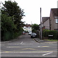
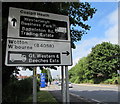
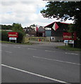
Living in BS37 0SD means being part of a small, rural community in South Gloucestershire, nestled between Yate and Bristol. The postcode covers a cluster of villages, including Westerleigh and Coalpit Heath, with hamlets like Henfield and Nibley. With a population of 1,939 and a density of 133 people per square kilometre, this is a quiet, tightly knit area. Its history is steeped in coal mining, which shaped the local economy until the mid-20th century. Today, the area retains a rural charm, with medieval churches like St James the Great and a network of footpaths, including the Frome Valley Walkway. Daily life is characterised by proximity to nature, with Bitterwell Lake and a 27-hole golf course offering leisure options. Residents benefit from nearby rail links, including Yate and Patchway stations, and a range of local shops, from Morrisons to independent retailers. The area’s small size means a strong sense of community, with amenities and services clustered around the villages. For those seeking a peaceful, low-density lifestyle with historical roots, BS37 0SD offers a unique blend of rural tranquillity and accessible connectivity.
- Area Type
- Postcode
- Area Size
- Not available
- Population
- 1939
- Population Density
- 133 people/km²
The property market in BS37 0SD is characterised by high home ownership (81%) and a predominance of houses, reflecting a suburban or rural housing stock. This suggests the area is not a rental hotspot but rather a place where residents are likely to own their homes long-term. The concentration of houses, rather than flats or apartments, indicates a focus on family homes and larger properties, which may appeal to buyers seeking space and privacy. Given the small size of the postcode area, the housing stock is limited, meaning buyers may need to look beyond BS37 0SD for more options. However, the proximity to nearby towns like Yate and Patchway offers additional choices. The high home ownership rate also implies a stable market, with fewer fluctuations in property values. For those prioritising a quiet, rural lifestyle with access to local amenities, BS37 0SD’s properties could be an attractive option, though the limited supply may require flexibility in location.
House Prices in BS37 0SD
No properties found in this postcode.
Energy Efficiency in BS37 0SD
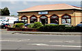
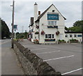
Life in BS37 0SD is shaped by its rural setting and small village character. Residents can access local shops like Morrisons and Tesco, as well as smaller independent retailers, ensuring daily necessities are within reach. The area’s proximity to nature is evident through amenities like Bitterwell Lake and the Frome Valley Walkway, offering opportunities for walking, cycling, or outdoor recreation. Leisure options include the Coalpit Heath Cricket Club and a 27-hole golf course at Kendleshire, catering to sports enthusiasts. The historic St James the Great Church and St Saviour’s parish church add cultural and architectural interest. With rail stations nearby, residents can easily reach larger towns for more extensive shopping, dining, or entertainment. The blend of local amenities and nearby urban access creates a balanced lifestyle, ideal for those seeking tranquillity without complete isolation from modern conveniences.
Amenities
Schools
The schools nearest to BS37 0SD include Vinney Green Secure Unit, which is categorised as an ‘other’ type, and Immanuel Christian School, an independent institution with a Good Ofsted rating. The presence of an independent school suggests options for families seeking private education, though it may be more expensive than state-run alternatives. Vinney Green Secure Unit, while not a traditional school, may cater to specific needs or populations, though its exact role is not detailed in the data. The limited number of schools reflects the area’s small size and rural nature, meaning families may need to travel to nearby towns for additional educational choices. However, the Good rating at Immanuel Christian School indicates a reliable option for those prioritising quality education. The mix of school types provides some diversity but does not offer a comprehensive range of state and private options.
| Rank | School | Type | Entry gender | Ages |
|---|
Explore more schools in this area
Go to Schools tabDemographics
The population of BS37 0SD is predominantly middle-aged, with a median age of 47 and the majority of residents falling within the 30-64 age range. This suggests a community with a strong presence of working-age adults and families. Home ownership is high at 81%, indicating stability and long-term residency. The accommodation type is primarily houses, reflecting a suburban or rural housing stock rather than flats or apartments. The predominant ethnic group is White, which aligns with the area’s historical and demographic profile. While specific data on deprivation is not provided, the high home ownership rate and moderate population density suggest a community with relatively stable economic conditions. The absence of detailed diversity metrics means the area’s social composition is likely homogenous, though this does not preclude pockets of diversity. The age profile implies a mature population, which may influence local services and amenities tailored to older residents.
Household Size
Accommodation Type
Tenure
Ethnic Group
Religion
Household Composition
Age
Household Deprivation
NS-SEC
Explore more demographic insights in this area
Go to Demographics tabPlanning
Planning Constraints
- Flood RiskPremium
- Ramsar Wetland SitesPremium
- Area of Outstanding Natural BeautyPremium
- Protected Nature ReservePremium
- Protected WoodlandPremium