Area Overview for BS36 2AB
Photos of BS36 2AB
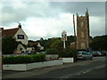
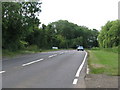
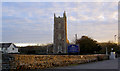
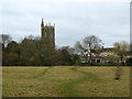
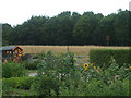

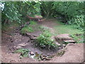
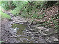
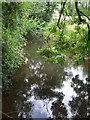
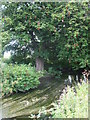
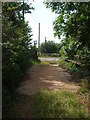
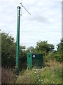
33 photos from this area
Area Information
Key information about the BS36 2AB including its size, population, and administrative classification.
- Area Type
- Postcode
- Area Size
- 3.8 hectares
- Population
- 1485
- Population Density
- 220 people/km²
House Prices in BS36 2AB
28
Properties
£285,397
Average Sold Price
£102,500
Lowest Price
£490,000
Highest Price
Showing 28 properties
| Address | Type | Beds | Baths | Last Sale Price | Last Sale Date | |
|---|---|---|---|---|---|---|
| 309 Church Road, Frampton Cotterell, BS36 2AB | Semi-detached | 3 | 1 | £370,000 | Jul 2025 | |
| 380 Church Road, Frampton Cotterell, BS36 2AB | Semi-detached | 4 | 2 | £490,000 | Jun 2021 | |
| 333 Church Road, Frampton Cotterell, BS36 2AB | Detached | 3 | 1 | £323,500 | May 2020 | |
| 323 Church Road, Frampton Cotterell, BS36 2AB | Chalet | 4 | 1 | £355,000 | Nov 2019 | |
| 341 Church Road, Frampton Cotterell, BS36 2AB | Detached | 3 | - | £370,000 | Oct 2019 | |
| 313 Church Road, Frampton Cotterell, BS36 2AB | Semi-detached | 3 | 1 | £320,000 | Feb 2018 | |
| 335 Church Road, Frampton Cotterell, BS36 2AB | Semi-detached | 4 | 1 | £375,000 | Jul 2017 | |
| 390 Church Road, Frampton Cotterell, BS36 2AB | Bungalow | 4 | - | £355,000 | Aug 2014 | |
| 321 Church Road, Frampton Cotterell, BS36 2AB | Bungalow | - | - | £285,000 | Dec 2013 | |
| 311 Church Road, Frampton Cotterell, BS36 2AB | Bungalow | - | - | £270,000 | Nov 2013 |
Page 1 of 3
Energy Efficiency in BS36 2AB
Amenities
Schools
| Rank | School | Type | Entry gender | Ages |
|---|
Explore more schools in this area
Go to Schools tabDemographics
Household Size
Two person
most common
Accommodation Type
Houses
most common
Tenure
90
majority
Ethnic Group
White
most common
Religion
N/A
most common
Household Composition
N/A
most common
Age
47
median
Adults (30-64 years)
most common
Household Deprivation
N/A
with no deprivation
NS-SEC
47
in Lower managerial occupations
Explore more demographic insights in this area
Go to Demographics tabPlanning
Planning Constraints
- Flood RiskPremium
- Ramsar Wetland SitesPremium
- Area of Outstanding Natural BeautyPremium
- Protected Nature ReservePremium
- Protected WoodlandPremium