Area Overview for BS36 1JL
Photos of BS36 1JL
Area Information
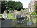
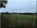
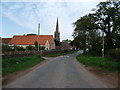
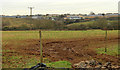
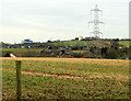
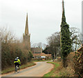
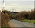
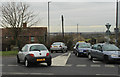
Living in BS36 1JL means residing in a small, tightly knit residential cluster within the village of Winterbourne, South Gloucestershire. The area covers 1.4 hectares and is home to 1,631 people, with a population density of 343 people per square kilometre. This is a village with deep historical roots, dating back to Roman times, and its settlements of Winterbourne, Frenchay, and Hambrook are interspersed with arable farmland and woodlands. The M4 motorway runs through the parish, linking to major cities like Bristol and Cardiff, offering easy access to urban centres while retaining a rural charm. Daily life here is shaped by its proximity to both nature and infrastructure, with the River Frome and surrounding green spaces providing a contrast to the convenience of nearby transport hubs. The area’s compact size means amenities are within practical reach, and its history is evident in landmarks like St Michael’s Church, which dates to the 12th century. For those seeking a balance between tranquillity and connectivity, BS36 1JL offers a distinctive blend of heritage and modernity.
- Area Type
- Postcode
- Area Size
- 1.4 hectares
- Population
- 1631
- Population Density
- 343 people/km²
The property market in BS36 1JL is dominated by owner-occupied homes, with 68% of properties owned by residents rather than rented. The accommodation type is predominantly houses, reflecting the rural and semi-rural character of the area. This contrasts with urban centres where flats and apartments are more common. The compact size of the postcode area—just 1.4 hectares—means the housing stock is limited, and properties are likely to be spread out rather than clustered. For buyers, this suggests a niche market with a focus on individual homes rather than larger developments. The high home ownership rate indicates that properties here are often held by residents for the long term, which can stabilise prices but also limit availability. Those seeking investment opportunities may find the market less dynamic, though the area’s proximity to transport links and amenities could appeal to buyers prioritising location over rapid capital growth. The mix of historical and modern housing, combined with the surrounding green spaces, makes this a unique proposition for those valuing a traditional village setting.
House Prices in BS36 1JL
No properties found in this postcode.
Energy Efficiency in BS36 1JL
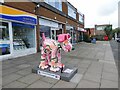
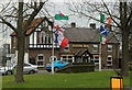
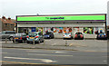
Residents of BS36 1JL enjoy a lifestyle enriched by nearby amenities that cater to daily needs. Retail options include Co-op Winterbourne, Tesco Winterbourne, and Spar Frampton, providing essential shopping within walking or short driving distance. For transport, five railway stations and the Oldland Metro station offer easy access to cities and suburbs, while ferries at Netham Lock and Castle Park provide scenic routes across the River Frome. The area’s historical and natural features, such as the parish church of St Michael the Archangel and surrounding woodlands, contribute to a distinct character. The presence of St Michael’s School and the Friends Meeting House in Frenchay adds to the community’s cultural fabric. While the village retains a quiet, rural feel, its proximity to the M4 and rail networks ensures that residents are well-connected to urban opportunities. The blend of local shops, transport links, and green spaces creates a convenient yet peaceful lifestyle, ideal for those seeking a balance between village life and accessibility.
Amenities
Schools
Residents of BS36 1JL have access to a range of educational institutions, including Hambrook Primary School, which holds a ‘good’ Ofsted rating, and The Ridings High School, a primary school without an explicit rating listed. Winterbourne Academy and The Ridings Federation Winterbourne International Academy are both academies, with the former also rated ‘good’ by Ofsted. This mix of primary schools and academies offers families options for both early education and secondary schooling. The presence of a ‘good’-rated primary school suggests a strong foundation for younger children, while the academies may provide specialist or broader curricula. For parents, the variety of school types allows for choices based on educational preferences, whether prioritising traditional structures or alternative approaches. The proximity of these schools to the area reinforces its appeal for families, ensuring that children have access to education without long commutes. The absence of specific ratings for all schools means potential buyers should verify current Ofsted reports for the most up-to-date assessments.
| Rank | School | Type | Entry gender | Ages |
|---|
Explore more schools in this area
Go to Schools tabDemographics
The community in BS36 1JL is predominantly composed of adults aged 30–64, with a median age of 47. This suggests a mature, stable population, likely with established careers and families. Home ownership is high at 68%, indicating a strong presence of long-term residents. The area is characterised by houses rather than flats, reflecting a traditional housing stock. The predominant ethnic group is White, which aligns with the broader demographic trends of rural South Gloucestershire. The population density of 343 people per square kilometre implies a low-density, spread-out settlement pattern, typical of a village setting. While specific data on deprivation is not provided, the high home ownership and stable age profile suggest a relatively secure economic environment. However, the medium crime risk score of 59 indicates that standard security measures are advisable, though not excessive. This demographic profile supports a community focused on family life, with a mix of long-term residents and those seeking a quieter lifestyle away from urban centres.
Household Size
Accommodation Type
Tenure
Ethnic Group
Religion
Household Composition
Age
Household Deprivation
NS-SEC
Explore more demographic insights in this area
Go to Demographics tabPlanning
Planning Constraints
- Flood RiskPremium
- Ramsar Wetland SitesPremium
- Area of Outstanding Natural BeautyPremium
- Protected Nature ReservePremium
- Protected WoodlandPremium