Area Overview for BS36 1HP
Photos of BS36 1HP
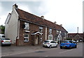
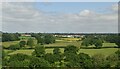
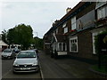
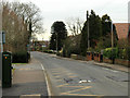
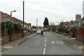
17 photos from this area
Area Information
Key information about the BS36 1HP including its size, population, and administrative classification.
- Area Type
- Postcode
- Area Size
- 3002 m²
- Population
- 1587
- Population Density
- 3775 people/km²
House Prices in BS36 1HP
11
Properties
£306,158
Average Sold Price
£68,500
Lowest Price
£412,500
Highest Price
Showing 11 properties
| Address | Type | Beds | Baths | Last Sale Price | Last Sale Date | |
|---|---|---|---|---|---|---|
| 124 Bradley Avenue, Winterbourne, BS36 1HP | house | - | - | £385,000 | Jul 2025 | |
| 118 Bradley Avenue, Winterbourne, BS36 1HP | Semi-detached | 3 | 2 | £412,500 | Oct 2023 | |
| 128 Bradley Avenue, Winterbourne, BS36 1HP | Semi-detached | 3 | 1 | £388,000 | Feb 2023 | |
| 114 Bradley Avenue, Winterbourne, BS36 1HP | Semi-detached | 4 | 2 | £378,000 | Mar 2019 | |
| 126 Bradley Avenue, Winterbourne, BS36 1HP | house | - | - | £204,950 | Oct 2006 | |
| 110 Bradley Avenue, Winterbourne, BS36 1HP | Terraced | - | - | £68,500 | Jul 1997 | |
| 120 Bradley Avenue, Winterbourne, BS36 1HP | Semi-detached | 3 | 1 | - | - | |
| 130 Bradley Avenue, Winterbourne, BS36 1HP | Terraced | - | - | - | - | |
| 122 Bradley Avenue, Winterbourne, BS36 1HP | Terraced | - | - | - | - | |
| 112 Bradley Avenue, Winterbourne, BS36 1HP | Terraced | - | - | - | - |
Page 1 of 2
Energy Efficiency in BS36 1HP
Amenities
Schools
| Rank | School | Type | Entry gender | Ages |
|---|
Explore more schools in this area
Go to Schools tabDemographics
Household Size
Family (3-5 people)
most common
Accommodation Type
Houses
most common
Tenure
86
majority
Ethnic Group
White
most common
Religion
N/A
most common
Household Composition
N/A
most common
Age
47
median
Adults (30-64 years)
most common
Household Deprivation
N/A
with no deprivation
NS-SEC
42
in Lower managerial occupations
Explore more demographic insights in this area
Go to Demographics tabPlanning
Planning Constraints
- Flood RiskPremium
- Ramsar Wetland SitesPremium
- Area of Outstanding Natural BeautyPremium
- Protected Nature ReservePremium
- Protected WoodlandPremium