Area Overview for BS35 4NT
Photos of BS35 4NT


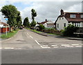
100 photos from this area
Area Information
Key information about the BS35 4NT including its size, population, and administrative classification.
- Area Type
- Postcode
- Area Size
- 1.7 hectares
- Population
- 1548
- Population Density
- 1055 people/km²
House Prices in BS35 4NT
59
Properties
£178,135
Average Sold Price
£52,950
Lowest Price
£385,000
Highest Price
Showing 59 properties
| Address | Type | Beds | Baths | Last Sale Price | Last Sale Date | |
|---|---|---|---|---|---|---|
| 248 Gorse Cover Road, Severn Beach, BS35 4NT | Terraced | 3 | - | £263,000 | Jul 2025 | |
| 236 Gorse Cover Road, Severn Beach, BS35 4NT | Semi-detached | 3 | 1 | £263,000 | Nov 2024 | |
| 198 Gorse Cover Road, Severn Beach, BS35 4NT | Detached | 4 | 2 | £385,000 | Jan 2024 | |
| 146 Gorse Cover Road, Severn Beach, BS35 4NT | Terraced | 3 | 1 | £260,000 | Aug 2023 | |
| 172 Gorse Cover Road, Severn Beach, BS35 4NT | house | - | - | £372,000 | Dec 2021 | |
| 202 Gorse Cover Road, Severn Beach, BS35 4NT | house | - | - | £290,000 | Jun 2021 | |
| 150 Gorse Cover Road, Severn Beach, BS35 4NT | Detached | 3 | 2 | £290,000 | Apr 2021 | |
| 222 Gorse Cover Road, Severn Beach, BS35 4NT | house | - | - | £213,000 | Jun 2020 | |
| 160 Gorse Cover Road, Severn Beach, BS35 4NT | house | - | - | £340,000 | Jun 2019 | |
| 164 Gorse Cover Road, Severn Beach, BS35 4NT | house | - | - | £203,500 | Jul 2018 |
Page 1 of 6
Energy Efficiency in BS35 4NT
Amenities
Schools
| Rank | School | Type | Entry gender | Ages |
|---|
Explore more schools in this area
Go to Schools tabDemographics
Household Size
Two person
most common
Accommodation Type
Houses
most common
Tenure
76
majority
Ethnic Group
White
most common
Religion
N/A
most common
Household Composition
N/A
most common
Age
47
median
Adults (30-64 years)
most common
Household Deprivation
N/A
with no deprivation
NS-SEC
25
in Lower managerial occupations
Explore more demographic insights in this area
Go to Demographics tabPlanning
Planning Constraints
- Flood RiskPremium
- Ramsar Wetland SitesPremium
- Area of Outstanding Natural BeautyPremium
- Protected Nature ReservePremium
- Protected WoodlandPremium