Area Overview for BS35 4HB
Photos of BS35 4HB
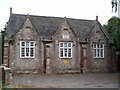
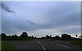
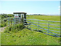
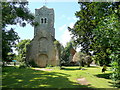
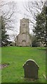
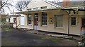
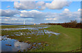
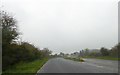
62 photos from this area
Area Information
Key information about the BS35 4HB including its size, population, and administrative classification.
- Area Type
- Postcode
- Area Size
- 14.9 hectares
- Population
- 2060
- Population Density
- 149 people/km²
House Prices in BS35 4HB
10
Properties
£181,333
Average Sold Price
£80,000
Lowest Price
£378,000
Highest Price
Showing 10 properties
| Address | Type | Beds | Baths | Last Sale Price | Last Sale Date | |
|---|---|---|---|---|---|---|
| Ross Cottage, Northwick Road, Pilning, BS35 4HB | house | - | - | £378,000 | Oct 2019 | |
| Meadow View, Northwick Road, Pilning, BS35 4HB | house | 3 | - | £275,000 | Aug 2012 | |
| Willowdene, Northwick Road, Pilning, BS35 4HB | Detached | - | - | £120,000 | Mar 2001 | |
| Sunnyside, Northwick Road, Pilning, BS35 4HB | Semi-detached | - | - | £145,000 | Apr 1998 | |
| Dove Cottage, Northwick Road, Pilning, BS35 4HB | Semi-detached | - | - | £90,000 | Apr 1998 | |
| Ingleside, Northwick Road, Pilning, BS35 4HB | Detached | 4 | 2 | £80,000 | Jan 1998 | |
| Northwick Hall, Northwick Road, Pilning, BS35 4HB | Retail | 8 | - | - | - | |
| Northwick House Farm, Northwick Road, Pilning, BS35 4HB | Detached | - | - | - | - | |
| Lydda, Northwick Road, Pilning, BS35 4HB | Semi-detached | - | - | - | - | |
| The Caravan, Ingleside, Northwick Road, Pilning, BS35 4HB | Mobile Home | - | - | - | - |
Energy Efficiency in BS35 4HB
Amenities
Schools
| Rank | School | Type | Entry gender | Ages |
|---|
Explore more schools in this area
Go to Schools tabDemographics
Household Size
Two person
most common
Accommodation Type
Houses
most common
Tenure
83
majority
Ethnic Group
White
most common
Religion
N/A
most common
Household Composition
N/A
most common
Age
47
median
Adults (30-64 years)
most common
Household Deprivation
N/A
with no deprivation
NS-SEC
34
in Lower managerial occupations
Explore more demographic insights in this area
Go to Demographics tabPlanning
Planning Constraints
- Flood RiskPremium
- Ramsar Wetland SitesPremium
- Area of Outstanding Natural BeautyPremium
- Protected Nature ReservePremium
- Protected WoodlandPremium