Area Overview for BS35 4DU
Photos of BS35 4DU
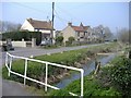

22 photos from this area
Area Information
Key information about the BS35 4DU including its size, population, and administrative classification.
- Area Type
- Postcode
- Area Size
- 6.6 hectares
- Population
- 1888
- Population Density
- 104 people/km²
House Prices in BS35 4DU
6
Properties
£600,000
Average Sold Price
£600,000
Lowest Price
£600,000
Highest Price
Showing 6 properties
| Address | Type | Beds | Baths | Last Sale Price | Last Sale Date | |
|---|---|---|---|---|---|---|
| The Great Barn, Denys Court, Olveston, BS35 4DU | Detached | - | - | £600,000 | Aug 2002 | |
| The Bee Garden, Denys Court, Olveston, BS35 4DU | Detached | - | - | - | - | |
| Olveston Court, Denys Court, Olveston, BS35 4DU | Detached | - | - | - | - | |
| Uws (south Gloucestershire) Ltd, Harnhill Quarry, Aust Road, Olveston, BS35 4DU | Industrial | - | - | - | - | |
| Courtlands, The Street, Olveston, BS35 4DU | Detached | - | - | - | - | |
| Tennis 37M From Olveston Court 15M From Unnamed Road, Denys Court, Olveston, BS35 4DU | Leisure | - | - | - | - |
Energy Efficiency in BS35 4DU
Amenities
Schools
| Rank | School | Type | Entry gender | Ages |
|---|
Explore more schools in this area
Go to Schools tabDemographics
Household Size
Two person
most common
Accommodation Type
Houses
most common
Tenure
86
majority
Ethnic Group
White
most common
Religion
N/A
most common
Household Composition
N/A
most common
Age
47
median
Adults (30-64 years)
most common
Household Deprivation
N/A
with no deprivation
NS-SEC
52
in Lower managerial occupations
Explore more demographic insights in this area
Go to Demographics tabPlanning
Planning Constraints
- Flood RiskPremium
- Ramsar Wetland SitesPremium
- Area of Outstanding Natural BeautyPremium
- Protected Nature ReservePremium
- Protected WoodlandPremium