Area Overview for BS35 3TA
Photos of BS35 3TA
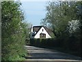
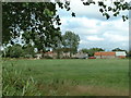
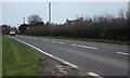
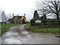
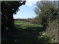
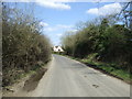
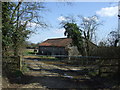
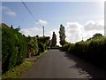
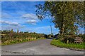
9 photos from this area
Area Information
Key information about the BS35 3TA including its size, population, and administrative classification.
- Area Type
- Postcode
- Area Size
- 1.1 km²
- Population
- 1528
- Population Density
- 160 people/km²
House Prices in BS35 3TA
24
Properties
£344,250
Average Sold Price
£100,000
Lowest Price
£677,750
Highest Price
Showing 24 properties
| Address | Type | Beds | Baths | Last Sale Price | Last Sale Date | |
|---|---|---|---|---|---|---|
| The Poplars, Earthcott Road, Alveston, BS35 3TA | house | - | - | £677,750 | Oct 2018 | |
| Emlett Farm, Latteridge Hill, Alveston, BS35 3TA | Cottage | 4 | 1 | £255,000 | May 2007 | |
| Emlett Cottage, Latteridge Hill, Alveston, BS35 3TA | Detached | - | - | £100,000 | Nov 1998 | |
| Gate Farmhouse, Earthcott Road, Alveston, BS35 3TA | house | - | - | - | - | |
| Open View Cottage, Earthcott Road, Alveston, BS35 3TA | Semi-detached | - | - | - | - | |
| Sunny Patch Cottage, Earthcott Road, Alveston, BS35 3TA | Semi-detached | - | - | - | - | |
| Meadow View, Earthcott Road, Alveston, BS35 3TA | Detached | - | - | - | - | |
| Grange Farm, Earthcott Road, Alveston, BS35 3TA | Detached | - | - | - | - | |
| The Old School House, Earthcott Road, Alveston, BS35 3TA | house | - | - | - | - | |
| Tregoyd, Earthcott Road, Alveston, BS35 3TA | Semi-detached | - | - | - | - |
Page 1 of 3
Energy Efficiency in BS35 3TA
Amenities
Schools
| Rank | School | Type | Entry gender | Ages |
|---|
Explore more schools in this area
Go to Schools tabDemographics
Household Size
Two person
most common
Accommodation Type
Houses
most common
Tenure
86
majority
Ethnic Group
White
most common
Religion
N/A
most common
Household Composition
N/A
most common
Age
47
median
Adults (30-64 years)
most common
Household Deprivation
N/A
with no deprivation
NS-SEC
45
in Lower managerial occupations
Explore more demographic insights in this area
Go to Demographics tabPlanning
Planning Constraints
- Flood RiskPremium
- Ramsar Wetland SitesPremium
- Area of Outstanding Natural BeautyPremium
- Protected Nature ReservePremium
- Protected WoodlandPremium