Area Overview for BS35 3RT
Photos of BS35 3RT
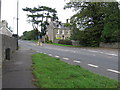
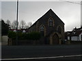
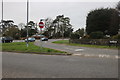
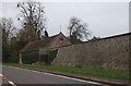
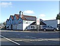
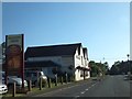
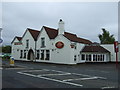
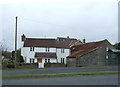
19 photos from this area
Area Information
Key information about the BS35 3RT including its size, population, and administrative classification.
- Area Type
- Postcode
- Area Size
- 4.9 hectares
- Population
- 1528
- Population Density
- 160 people/km²
House Prices in BS35 3RT
29
Properties
£290,788
Average Sold Price
£86,000
Lowest Price
£495,000
Highest Price
Showing 29 properties
| Address | Type | Beds | Baths | Last Sale Price | Last Sale Date | |
|---|---|---|---|---|---|---|
| Stonycroft, 48 Gloucester Road, Rudgeway, BS35 3RT | house | - | - | £305,000 | Aug 2024 | |
| Talland, 34 Gloucester Road, Rudgeway, BS35 3RT | Bungalow | 2 | - | £345,000 | Jan 2022 | |
| The Moorings, 30 Gloucester Road, Rudgeway, BS35 3RT | Semi-detached | 4 | - | £350,000 | Dec 2020 | |
| Sunnydale, 36 Gloucester Road, Rudgeway, BS35 3RT | Bungalow | 3 | 1 | £265,000 | Oct 2020 | |
| Rocklands, 54 Gloucester Road, Rudgeway, BS35 3RT | Semi-detached | 3 | 2 | £352,500 | Jul 2020 | |
| West View, 46 Gloucester Road, Rudgeway, BS35 3RT | Semi-detached | 3 | 1 | £350,000 | Aug 2018 | |
| Honeysuckle Cottage, 60 Gloucester Road, Rudgeway, BS35 3RT | Cottage | 2 | 1 | £307,000 | Nov 2017 | |
| Lyndene, 28 Gloucester Road, Rudgeway, BS35 3RT | Semi-detached | 5 | 2 | £450,000 | Sep 2017 | |
| Red Lodge, 40 Gloucester Road, Rudgeway, BS35 3RT | Bungalow | 4 | 2 | £495,000 | Feb 2016 | |
| 64A Gloucester Road, Rudgeway, BS35 3RT | house | 3 | - | £292,250 | May 2014 |
Page 1 of 3
Energy Efficiency in BS35 3RT
Amenities
Schools
| Rank | School | Type | Entry gender | Ages |
|---|
Explore more schools in this area
Go to Schools tabDemographics
Household Size
Two person
most common
Accommodation Type
Houses
most common
Tenure
86
majority
Ethnic Group
White
most common
Religion
N/A
most common
Household Composition
N/A
most common
Age
47
median
Adults (30-64 years)
most common
Household Deprivation
N/A
with no deprivation
NS-SEC
45
in Lower managerial occupations
Explore more demographic insights in this area
Go to Demographics tabPlanning
Planning Constraints
- Flood RiskPremium
- Ramsar Wetland SitesPremium
- Area of Outstanding Natural BeautyPremium
- Protected Nature ReservePremium
- Protected WoodlandPremium