Area Overview for BS35 1NR
Photos of BS35 1NR

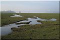
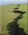
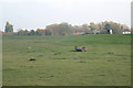
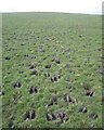
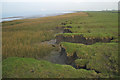
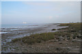
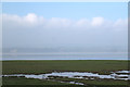
29 photos from this area
Area Information
Key information about the BS35 1NR including its size, population, and administrative classification.
- Area Type
- Postcode
- Area Size
- 1.2 km²
- Population
- 1749
- Population Density
- 39 people/km²
House Prices in BS35 1NR
32
Properties
£509,563
Average Sold Price
£140,000
Lowest Price
£775,000
Highest Price
Showing 32 properties
| Address | Type | Beds | Baths | Last Sale Price | Last Sale Date | |
|---|---|---|---|---|---|---|
| Littleton Manor, Village Road, Littleton Upon Severn, BS35 1NR | Detached | 4 | 2 | £432,500 | Mar 2023 | |
| White Willows, Village Road, Littleton Upon Severn, BS35 1NR | Detached | 4 | 2 | £638,000 | Jan 2023 | |
| Quarry House, Village Road, Littleton Upon Severn, BS35 1NR | Detached | 5 | 3 | £775,000 | Aug 2018 | |
| Willow Barn, Village Road, Littleton Upon Severn, BS35 1NR | house | - | - | £730,000 | Sep 2013 | |
| Walnut Tree Cottage, Village Road, Littleton Upon Severn, BS35 1NR | house | - | - | £573,000 | Sep 2012 | |
| Rusholme, Village Road, Littleton Upon Severn, BS35 1NR | house | - | - | £601,000 | Jan 2012 | |
| Rose Cottage, Village Road, Littleton Upon Severn, BS35 1NR | Semi-detached | - | - | £187,000 | Jul 1997 | |
| Croft Cottage, Village Road, Littleton Upon Severn, BS35 1NR | Detached | - | - | £140,000 | Feb 1995 | |
| Orchard House, Village Road, Littleton Upon Severn, BS35 1NR | Detached | 4 | 2 | - | - | |
| Applegarth, Village Road, Littleton Upon Severn, BS35 1NR | Detached | 2 | 1 | - | - |
Page 1 of 4
Energy Efficiency in BS35 1NR
Amenities
Schools
| Rank | School | Type | Entry gender | Ages |
|---|
Explore more schools in this area
Go to Schools tabDemographics
Household Size
Two person
most common
Accommodation Type
Houses
most common
Tenure
81
majority
Ethnic Group
White
most common
Religion
N/A
most common
Household Composition
N/A
most common
Age
47
median
Adults (30-64 years)
most common
Household Deprivation
N/A
with no deprivation
NS-SEC
46
in Lower managerial occupations
Explore more demographic insights in this area
Go to Demographics tabPlanning
Planning Constraints
- Flood RiskPremium
- Ramsar Wetland SitesPremium
- Area of Outstanding Natural BeautyPremium
- Protected Nature ReservePremium
- Protected WoodlandPremium