Area Overview for BS35 1EX
Photos of BS35 1EX

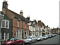
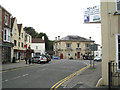
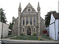
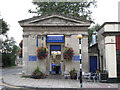
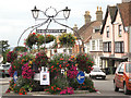
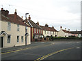
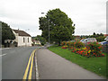
100 photos from this area
Area Information
Key information about the BS35 1EX including its size, population, and administrative classification.
- Area Type
- Postcode
- Area Size
- 2.0 hectares
- Population
- Not available
- Population Density
- Not available
House Prices in BS35 1EX
29
Properties
£287,321
Average Sold Price
£155,000
Lowest Price
£500,000
Highest Price
Showing 29 properties
| Address | Type | Beds | Baths | Last Sale Price | Last Sale Date | |
|---|---|---|---|---|---|---|
| 40 Severn Drive, Thornbury, BS35 1EX | Detached | 4 | - | £400,000 | Sep 2020 | |
| 46 Severn Drive, Thornbury, BS35 1EX | Detached | - | - | £320,000 | Apr 2019 | |
| 38 Severn Drive, Thornbury, BS35 1EX | Detached | 3 | 1 | £315,000 | Mar 2019 | |
| 34 Severn Drive, Thornbury, BS35 1EX | Semi-detached | 4 | - | £450,000 | Jul 2016 | |
| 28 Severn Drive, Thornbury, BS35 1EX | Detached | 3 | - | £290,000 | Jun 2013 | |
| 6 Severn Drive, Thornbury, BS35 1EX | house | 3 | - | £250,000 | Aug 2011 | |
| 2A Severn Drive, Thornbury, BS35 1EX | Detached | - | - | £500,000 | Jun 2011 | |
| 32 Severn Drive, Thornbury, BS35 1EX | Terraced | - | - | £245,000 | May 2009 | |
| 30 Severn Drive, Thornbury, BS35 1EX | Terraced | - | - | £295,000 | Jun 2006 | |
| 16 Severn Drive, Thornbury, BS35 1EX | Semi-detached | - | - | £155,000 | May 2006 |
Page 1 of 3
Energy Efficiency in BS35 1EX
Amenities
Schools
| Rank | School | Type | Entry gender | Ages |
|---|
Explore more schools in this area
Go to Schools tabDemographics
Household Size
Family (3-5 people)
most common
Accommodation Type
Houses
most common
Tenure
84
majority
Ethnic Group
White
most common
Religion
N/A
most common
Household Composition
N/A
most common
Age
47
median
Adults (30-64 years)
most common
Household Deprivation
N/A
with no deprivation
NS-SEC
50
in Lower managerial occupations
Explore more demographic insights in this area
Go to Demographics tabPlanning
Planning Constraints
- Flood RiskPremium
- Ramsar Wetland SitesPremium
- Area of Outstanding Natural BeautyPremium
- Protected Nature ReservePremium
- Protected WoodlandPremium