Area Overview for BS34 8UX
Photos of BS34 8UX
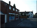
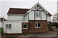
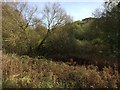
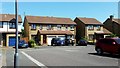
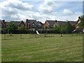
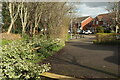
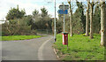
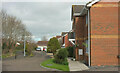
32 photos from this area
Area Information
Key information about the BS34 8UX including its size, population, and administrative classification.
- Area Type
- Postcode
- Area Size
- 1.4 hectares
- Population
- 1531
- Population Density
- 5143 people/km²
House Prices in BS34 8UX
31
Properties
£211,740
Average Sold Price
£44,000
Lowest Price
£400,000
Highest Price
Showing 31 properties
| Address | Type | Beds | Baths | Last Sale Price | Last Sale Date | |
|---|---|---|---|---|---|---|
| 60 Gadshill Drive, Stoke Gifford, BS34 8UX | Semi-detached | 3 | 1 | £387,000 | Sep 2025 | |
| 42 Gadshill Drive, Stoke Gifford, BS34 8UX | Semi-detached | 3 | 1 | £385,000 | Mar 2025 | |
| 20 Gadshill Drive, Stoke Gifford, BS34 8UX | house | 3 | 1 | £381,500 | Dec 2022 | |
| 58 Gadshill Drive, Stoke Gifford, BS34 8UX | house | - | - | £400,000 | Feb 2022 | |
| 12 Gadshill Drive, Stoke Gifford, BS34 8UX | house | - | - | £370,000 | Apr 2021 | |
| 14 Gadshill Drive, Stoke Gifford, BS34 8UX | Semi-detached | 3 | - | £325,000 | Jan 2021 | |
| 6 Gadshill Drive, Stoke Gifford, BS34 8UX | Detached | 4 | 2 | £358,000 | Nov 2018 | |
| 32 Gadshill Drive, Stoke Gifford, BS34 8UX | Semi-detached | 3 | 1 | £270,000 | Sep 2018 | |
| 28 Gadshill Drive, Stoke Gifford, BS34 8UX | Semi-detached | 3 | 1 | £287,000 | Jan 2018 | |
| 50 Gadshill Drive, Stoke Gifford, BS34 8UX | house | 3 | - | £209,000 | Nov 2011 |
Page 1 of 4
Energy Efficiency in BS34 8UX
Amenities
Schools
| Rank | School | Type | Entry gender | Ages |
|---|
Explore more schools in this area
Go to Schools tabDemographics
Household Size
Two person
most common
Accommodation Type
Houses
most common
Tenure
87
majority
Ethnic Group
White
most common
Religion
N/A
most common
Household Composition
N/A
most common
Age
47
median
Adults (30-64 years)
most common
Household Deprivation
N/A
with no deprivation
NS-SEC
47
in Lower managerial occupations
Explore more demographic insights in this area
Go to Demographics tabPlanning
Planning Constraints
- Flood RiskPremium
- Ramsar Wetland SitesPremium
- Area of Outstanding Natural BeautyPremium
- Protected Nature ReservePremium
- Protected WoodlandPremium