Area Overview for BS34 8PB
Photos of BS34 8PB

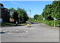
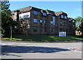
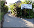
100 photos from this area
Area Information
Key information about the BS34 8PB including its size, population, and administrative classification.
- Area Type
- Postcode
- Area Size
- 1.9 hectares
- Population
- 1744
- Population Density
- 2674 people/km²
House Prices in BS34 8PB
10
Properties
£240,000
Average Sold Price
£230,000
Lowest Price
£250,000
Highest Price
Showing 10 properties
| Address | Type | Beds | Baths | Last Sale Price | Last Sale Date | |
|---|---|---|---|---|---|---|
| Calderstone, 30 North Road, Stoke Gifford, BS34 8PB | Semi-detached | 4 | 2 | £250,000 | Aug 2014 | |
| Sunbury, 28 North Road, Stoke Gifford, BS34 8PB | Bungalow | 4 | - | £230,000 | Feb 2013 | |
| Flat 3, Parkway Apartments, 43 North Road, Stoke Gifford, BS34 8PB | Flat | 4 | - | - | - | |
| Flat 4, Parkway Apartments, 43 North Road, Stoke Gifford, BS34 8PB | Flat | 4 | - | - | - | |
| Flat 1, Parkway Apartments, 43 North Road, Stoke Gifford, BS34 8PB | Flat | 5 | - | - | - | |
| Flat 2, Parkway Apartments, 43 North Road, Stoke Gifford, BS34 8PB | Flat | 4 | - | - | - | |
| Flat, 39 North Road, Stoke Gifford, BS34 8PB | Flat | 4 | 1 | - | - | |
| Flat, Parkway Tavern, 43 North Road, Stoke Gifford, BS34 8PB | restaurant_cafe | - | - | - | - | |
| Flat, Beaufort Arms, 55 North Road, Stoke Gifford, BS34 8PB | Flat | - | - | - | - | |
| Mitchells & Butlers Retail Ltd, Beaufort Arms, 55 North Road, Stoke Gifford, BS34 8PB | Leisure | - | - | - | - |
Energy Efficiency in BS34 8PB
Amenities
Schools
| Rank | School | Type | Entry gender | Ages |
|---|
Explore more schools in this area
Go to Schools tabDemographics
Household Size
Family (3-5 people)
most common
Accommodation Type
Houses
most common
Tenure
68
majority
Ethnic Group
White
most common
Religion
N/A
most common
Household Composition
N/A
most common
Age
47
median
Adults (30-64 years)
most common
Household Deprivation
N/A
with no deprivation
NS-SEC
43
in Lower managerial occupations
Explore more demographic insights in this area
Go to Demographics tabPlanning
Planning Constraints
- Flood RiskPremium
- Ramsar Wetland SitesPremium
- Area of Outstanding Natural BeautyPremium
- Protected Nature ReservePremium
- Protected WoodlandPremium