Area Overview for BS34 8NP
Photos of BS34 8NP
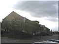
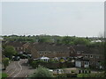
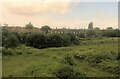
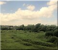
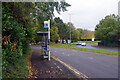
32 photos from this area
Area Information
Key information about the BS34 8NP including its size, population, and administrative classification.
- Area Type
- Postcode
- Area Size
- 3065 m²
- Population
- Not available
- Population Density
- Not available
House Prices in BS34 8NP
10
Properties
£178,833
Average Sold Price
£44,000
Lowest Price
£326,000
Highest Price
Showing 10 properties
| Address | Type | Beds | Baths | Last Sale Price | Last Sale Date | |
|---|---|---|---|---|---|---|
| 21 Sandringham Road, Stoke Gifford, BS34 8NP | Detached | 2 | 1 | £326,000 | Jan 2025 | |
| 12 Sandringham Road, Stoke Gifford, BS34 8NP | Terraced | 2 | 1 | £230,050 | Feb 2019 | |
| 19 Sandringham Road, Stoke Gifford, BS34 8NP | Semi-detached | 2 | 1 | £175,000 | Jul 2015 | |
| 6 Sandringham Road, Stoke Gifford, BS34 8NP | Terraced | 3 | 1 | £156,950 | Mar 2006 | |
| 4 Sandringham Road, Stoke Gifford, BS34 8NP | house | 3 | - | £141,000 | Mar 2006 | |
| 23 Sandringham Road, Stoke Gifford, BS34 8NP | Detached | - | - | £44,000 | Apr 1996 | |
| 8 Sandringham Road, Stoke Gifford, BS34 8NP | Terraced | - | - | - | - | |
| 2 Sandringham Road, Stoke Gifford, BS34 8NP | house | - | - | - | - | |
| 14 Sandringham Road, Stoke Gifford, BS34 8NP | Detached | 3 | - | - | - | |
| 10 Sandringham Road, Stoke Gifford, BS34 8NP | Terraced | - | - | - | - |
Energy Efficiency in BS34 8NP
Amenities
Schools
| Rank | School | Type | Entry gender | Ages |
|---|
Explore more schools in this area
Go to Schools tabDemographics
Household Size
Two person
most common
Accommodation Type
Houses
most common
Tenure
81
majority
Ethnic Group
White
most common
Religion
N/A
most common
Household Composition
N/A
most common
Age
47
median
Adults (30-64 years)
most common
Household Deprivation
N/A
with no deprivation
NS-SEC
45
in Lower managerial occupations
Explore more demographic insights in this area
Go to Demographics tabPlanning
Planning Constraints
- Flood RiskPremium
- Ramsar Wetland SitesPremium
- Area of Outstanding Natural BeautyPremium
- Protected Nature ReservePremium
- Protected WoodlandPremium