Area Overview for BS34 7PS
Photos of BS34 7PS

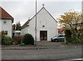
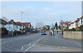
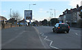

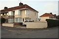

100 photos from this area
Area Information
Key information about the BS34 7PS including its size, population, and administrative classification.
- Area Type
- Postcode
- Area Size
- 5.6 hectares
- Population
- 1748
- Population Density
- 1465 people/km²
House Prices in BS34 7PS
10
Properties
£176,500
Average Sold Price
£51,000
Lowest Price
£525,000
Highest Price
Showing 10 properties
| Address | Type | Beds | Baths | Last Sale Price | Last Sale Date | |
|---|---|---|---|---|---|---|
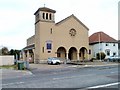
| Flat, St Andrews Methodist Church, Elm Park, Filton, BS34 7PS | Flat | - | - | £525,000 | Jul 2024 | |
| 43 Elm Park, Filton, BS34 7PS | Semi-detached | - | - | £181,000 | Sep 2003 | |
| 51 Elm Park, Filton, BS34 7PS | Semi-detached | 5 | 2 | £113,000 | May 2001 | |
| 47 Elm Park, Filton, BS34 7PS | house | 3 | 1 | £122,500 | Jul 2000 | |
| 49 Elm Park, Filton, BS34 7PS | Bungalow | - | - | £66,500 | Oct 1998 | |
| 45 Elm Park, Filton, BS34 7PS | Semi-detached | - | - | £51,000 | Jul 1998 | |
| Foundation For Active Community Engagement, Youth Centre, St Andrews Methodist Church, Elm Park, Filton, BS34 7PS | commercial | - | - | - | - | |
| 41 Elm Park, Filton, BS34 7PS | Semi-detached | - | - | - | - | |
| Filton Parish Council, Filton Town Council, Elm Park, Filton, BS34 7PS | commercial | - | - | - | - | |
| Stewards Flat, Filton Sports And Leisure Centre, Elm Park, Filton, BS34 7PS | Flat | - | - | - | - |
Energy Efficiency in BS34 7PS
Amenities
Schools
| Rank | School | Type | Entry gender | Ages |
|---|
Explore more schools in this area
Go to Schools tabDemographics
Household Size
One person
most common
Accommodation Type
Flats
most common
Tenure
44
majority
Ethnic Group
White
most common
Religion
N/A
most common
Household Composition
N/A
most common
Age
47
median
Adults (30-64 years)
most common
Household Deprivation
N/A
with no deprivation
NS-SEC
27
in Lower managerial occupations
Explore more demographic insights in this area
Go to Demographics tabPlanning
Planning Constraints
- Flood RiskPremium
- Ramsar Wetland SitesPremium
- Area of Outstanding Natural BeautyPremium
- Protected Nature ReservePremium
- Protected WoodlandPremium