Area Overview for BS34 6JT
Photos of BS34 6JT


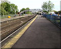
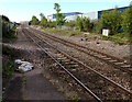
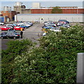
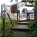
61 photos from this area
Area Information
Key information about the BS34 6JT including its size, population, and administrative classification.
- Area Type
- Postcode
- Area Size
- 2.4 hectares
- Population
- Not available
- Population Density
- Not available
House Prices in BS34 6JT
29
Properties
£212,192
Average Sold Price
£35,750
Lowest Price
£401,250
Highest Price
Showing 29 properties
| Address | Type | Beds | Baths | Last Sale Price | Last Sale Date | |
|---|---|---|---|---|---|---|
| 3 Rossall Avenue, Little Stoke, BS34 6JT | house | - | - | £320,000 | Aug 2023 | |
| 9 Rossall Avenue, Little Stoke, BS34 6JT | Semi-detached | 3 | 1 | £401,250 | Jul 2023 | |
| 5 Rossall Avenue, Little Stoke, BS34 6JT | Semi-detached | 3 | 1 | £335,000 | Feb 2023 | |
| 19 Rossall Avenue, Little Stoke, BS34 6JT | Terraced | 3 | 1 | £245,000 | Jan 2020 | |
| Helendean, Rossall Avenue, Little Stoke, BS34 6JT | Semi-detached | 3 | 1 | £232,500 | Oct 2019 | |
| 17 Rossall Avenue, Little Stoke, BS34 6JT | Semi-detached | 3 | 1 | £261,000 | Mar 2019 | |
| 32 Rossall Avenue, Little Stoke, BS34 6JT | Semi-detached | 3 | - | £230,000 | May 2018 | |
| 15 Rossall Avenue, Little Stoke, BS34 6JT | Semi-detached | 3 | - | £220,000 | Jan 2016 | |
| 11 Rossall Avenue, Little Stoke, BS34 6JT | house | 3 | 1 | £185,000 | Jul 2012 | |
| 18 Rossall Avenue, Little Stoke, BS34 6JT | Semi-detached | - | - | £100,000 | Oct 2004 |
Page 1 of 3
Energy Efficiency in BS34 6JT
Amenities
Schools
| Rank | School | Type | Entry gender | Ages |
|---|
Explore more schools in this area
Go to Schools tabDemographics
Household Size
Family (3-5 people)
most common
Accommodation Type
Houses
most common
Tenure
71
majority
Ethnic Group
White
most common
Religion
N/A
most common
Household Composition
N/A
most common
Age
47
median
Adults (30-64 years)
most common
Household Deprivation
N/A
with no deprivation
NS-SEC
29
in Lower managerial occupations
Explore more demographic insights in this area
Go to Demographics tabPlanning
Planning Constraints
- Flood RiskPremium
- Ramsar Wetland SitesPremium
- Area of Outstanding Natural BeautyPremium
- Protected Nature ReservePremium
- Protected WoodlandPremium