Area Overview for BS34 5TP
Photos of BS34 5TP


Area Information
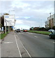
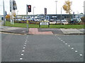
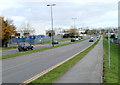
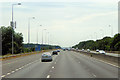
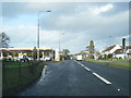
BS34 5TP is a small residential postcode area nestled in the heart of Almondsbury, a village in southern Gloucestershire. With a population of 2,353 people spread across 114 residents per square kilometre, it reflects a quiet, close-knit community. The area lies near junction 16 of the M5 motorway and along the A38 road, placing it at the crossroads of Bristol and Gloucester. This strategic location offers easy access to urban amenities while retaining the village’s historic charm. Almondsbury itself is a blend of medieval heritage and modern infrastructure, from its 12th-century church to the M4/M5 Almondsbury Interchange, Britain’s first four-level motorway crossing. Daily life here balances proximity to major transport routes with a traditional village feel, where the Bowl Inn, a 15th-century building, still stands as a local landmark. The area’s appeal lies in its accessibility to Bristol’s economic hubs and its retention of rural character, making it a practical choice for commuters and families seeking a quieter lifestyle.
- Area Type
- Postcode
- Area Size
- Not available
- Population
- 2353
- Population Density
- 114 people/km²
The property market in BS34 5TP is characterised by a high rate of home ownership (77%) and a predominance of houses as the primary accommodation type. This suggests a market skewed towards owner-occupied homes rather than rental properties, likely attracting families and long-term residents. The presence of houses indicates a mix of older, traditional properties and newer developments, though specific details on property ages or styles are not provided. Given the area’s proximity to major transport routes like the M5 and A38, it may appeal to buyers seeking a balance between suburban living and urban accessibility. However, the small size of the postcode area means the housing stock is limited, and buyers should consider nearby suburbs like Patchway or Bradley Stoke for more options. The market is likely competitive, with demand driven by the area’s strategic location and historic character.
House Prices in BS34 5TP
No properties found in this postcode.
Energy Efficiency in BS34 5TP
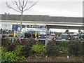
Residents of BS34 5TP have access to a range of amenities within practical reach. The retail sector includes Makro Bristol, Morrisons Patchway, and M&S Cribbs, offering shopping options from everyday essentials to specialist goods. For transport, five rail stations and three ferry landings provide multiple routes to Bristol and surrounding areas. The area’s historic character is complemented by its proximity to natural and cultural sites, such as Almondsbury Hill and St Mary the Virgin church. The presence of the Bowl Inn, a Grade II listed building, adds to the village’s charm. While the data does not detail parks or leisure facilities directly, the area’s mix of retail, transport, and heritage sites suggests a lifestyle that balances convenience with a touch of tradition.
Amenities
Schools
The nearest school to BS34 5TP is Highdene School, an independent institution. While no Ofsted rating is provided, the presence of an independent school suggests the area may attract families prioritising private education. Independent schools often offer smaller class sizes, specialised curricula, and extracurricular opportunities, which can be a significant draw for parents. However, the absence of state schools in the data means families reliant on public education may need to look further afield, potentially increasing commuting times. The mix of school types—here, solely independent—reflects the area’s demographic profile, where home ownership and family-oriented living are prominent. Buyers should verify the availability of state schools in nearby towns like Bristol or Gloucester if they require a broader range of educational options.
| Rank | School | Type | Entry gender | Ages |
|---|
Explore more schools in this area
Go to Schools tabDemographics
The community in BS34 5TP is predominantly middle-aged, with a median age of 47 and the most common age range being adults aged 30–64. This suggests a stable population with strong ties to the area. Home ownership is high at 77%, indicating a long-term resident base rather than a transient rental market. The accommodation type is primarily houses, reflecting a suburban or semi-rural character. The predominant ethnic group is White, which aligns with the broader demographic profile of the region. The population density of 114 people per square kilometre suggests a low-density, spread-out settlement typical of smaller villages. This combination of factors—older residents, owner-occupied homes, and a focus on family housing—shapes a community that values stability and local connections over rapid change.
Household Size
Accommodation Type
Tenure
Ethnic Group
Religion
Household Composition
Age
Household Deprivation
NS-SEC
Explore more demographic insights in this area
Go to Demographics tabPlanning
Planning Constraints
- Flood RiskPremium
- Ramsar Wetland SitesPremium
- Area of Outstanding Natural BeautyPremium
- Protected Nature ReservePremium
- Protected WoodlandPremium