Area Overview for BS34 5DS
Photos of BS34 5DS
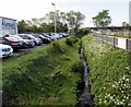
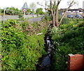
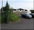
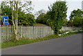
77 photos from this area
Area Information
Key information about the BS34 5DS including its size, population, and administrative classification.
- Area Type
- Postcode
- Area Size
- 1.3 hectares
- Population
- Not available
- Population Density
- Not available
House Prices in BS34 5DS
30
Properties
£272,417
Average Sold Price
£122,000
Lowest Price
£405,000
Highest Price
Showing 30 properties
| Address | Type | Beds | Baths | Last Sale Price | Last Sale Date | |
|---|---|---|---|---|---|---|
| 32 Hazeldene Road, Patchway, BS34 5DS | Bungalow | 3 | 1 | £405,000 | Dec 2024 | |
| 42 Hazeldene Road, Patchway, BS34 5DS | house | - | - | £290,000 | Nov 2022 | |
| 28 Hazeldene Road, Patchway, BS34 5DS | Bungalow | - | - | £391,000 | Mar 2022 | |
| 22 Hazeldene Road, Patchway, BS34 5DS | Bungalow | 3 | 2 | £315,000 | Apr 2021 | |
| 38 Hazeldene Road, Patchway, BS34 5DS | Bungalow | 2 | 1 | £320,000 | Mar 2020 | |
| 26 Hazeldene Road, Patchway, BS34 5DS | Bungalow | 2 | 1 | £319,500 | Sep 2018 | |
| 48 Hazeldene Road, Patchway, BS34 5DS | Bungalow | 3 | 1 | £350,000 | Nov 2017 | |
| 44 Hazeldene Road, Patchway, BS34 5DS | Semi-detached | 2 | - | £218,500 | Nov 2015 | |
| 2A Hazeldene Road, Patchway, BS34 5DS | Bungalow | 2 | - | £198,000 | Jul 2012 | |
| 46 Hazeldene Road, Patchway, BS34 5DS | Bungalow | 3 | - | £185,000 | Feb 2010 |
Page 1 of 3
Energy Efficiency in BS34 5DS
Amenities
Schools
| Rank | School | Type | Entry gender | Ages |
|---|
Explore more schools in this area
Go to Schools tabDemographics
Household Size
Family (3-5 people)
most common
Accommodation Type
Houses
most common
Tenure
78
majority
Ethnic Group
White
most common
Religion
N/A
most common
Household Composition
N/A
most common
Age
47
median
Adults (30-64 years)
most common
Household Deprivation
N/A
with no deprivation
NS-SEC
36
in Lower managerial occupations
Explore more demographic insights in this area
Go to Demographics tabPlanning
Planning Constraints
- Flood RiskPremium
- Ramsar Wetland SitesPremium
- Area of Outstanding Natural BeautyPremium
- Protected Nature ReservePremium
- Protected WoodlandPremium