Area Overview for BS32 8BN
Photos of BS32 8BN
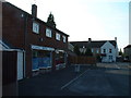
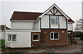
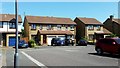
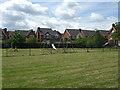
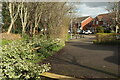
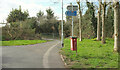
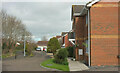
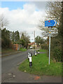
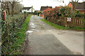
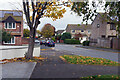
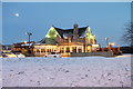
32 photos from this area
Area Information
Key information about the BS32 8BN including its size, population, and administrative classification.
- Area Type
- Postcode
- Area Size
- 1.7 hectares
- Population
- Not available
- Population Density
- Not available
House Prices in BS32 8BN
67
Properties
£155,511
Average Sold Price
£41,000
Lowest Price
£365,080
Highest Price
Showing 67 properties
| Address | Type | Beds | Baths | Last Sale Price | Last Sale Date | |
|---|---|---|---|---|---|---|
| 30 Meadow Way, Bradley Stoke, BS32 8BN | Terraced | 3 | 1 | £355,000 | Jul 2025 | |
| 18 Meadow Way, Bradley Stoke, BS32 8BN | Terraced | 2 | 1 | £270,300 | Aug 2024 | |
| 14 Meadow Way, Bradley Stoke, BS32 8BN | Terraced | 2 | 1 | £240,000 | Jul 2024 | |
| 47 Meadow Way, Bradley Stoke, BS32 8BN | Terraced | 1 | 1 | £215,000 | Aug 2023 | |
| 2 Meadow Way, Bradley Stoke, BS32 8BN | Bungalow | 2 | 1 | £365,080 | Dec 2022 | |
| 41 Meadow Way, Bradley Stoke, BS32 8BN | Flat | - | - | £153,750 | Jun 2022 | |
| 8 Meadow Way, Bradley Stoke, BS32 8BN | Maisonette | 1 | 1 | £185,000 | Nov 2021 | |
| 45 Meadow Way, Bradley Stoke, BS32 8BN | Flat | - | - | £139,000 | Oct 2021 | |
| 85 Meadow Way, Bradley Stoke, BS32 8BN | house | - | - | £178,000 | Apr 2021 | |
| 77 Meadow Way, Bradley Stoke, BS32 8BN | house | - | - | £186,500 | Dec 2020 |
Page 1 of 7
Energy Efficiency in BS32 8BN
Amenities
Schools
| Rank | School | Type | Entry gender | Ages |
|---|
Explore more schools in this area
Go to Schools tabDemographics
Household Size
Two person
most common
Accommodation Type
Houses
most common
Tenure
71
majority
Ethnic Group
White
most common
Religion
N/A
most common
Household Composition
N/A
most common
Age
47
median
Adults (30-64 years)
most common
Household Deprivation
N/A
with no deprivation
NS-SEC
45
in Lower managerial occupations
Explore more demographic insights in this area
Go to Demographics tabPlanning
Planning Constraints
- Flood RiskPremium
- Ramsar Wetland SitesPremium
- Area of Outstanding Natural BeautyPremium
- Protected Nature ReservePremium
- Protected WoodlandPremium