Area Overview for BS32 0AJ
Photos of BS32 0AJ
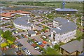
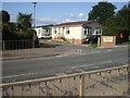
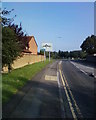
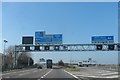


60 photos from this area
Area Information
Key information about the BS32 0AJ including its size, population, and administrative classification.
- Area Type
- Postcode
- Area Size
- 2.3 hectares
- Population
- 1748
- Population Density
- 2180 people/km²
House Prices in BS32 0AJ
63
Properties
£221,002
Average Sold Price
£11,100
Lowest Price
£428,000
Highest Price
Showing 63 properties
| Address | Type | Beds | Baths | Last Sale Price | Last Sale Date | |
|---|---|---|---|---|---|---|
| 42 Ottrells Mead, Bradley Stoke, BS32 0AJ | Semi-detached | 2 | 1 | £268,000 | Oct 2024 | |
| 43 Ottrells Mead, Bradley Stoke, BS32 0AJ | Semi-detached | 2 | 1 | £260,000 | Feb 2024 | |
| 48 Ottrells Mead, Bradley Stoke, BS32 0AJ | Semi-detached | 2 | 1 | £268,000 | Jan 2024 | |
| 53 Ottrells Mead, Bradley Stoke, BS32 0AJ | Terraced | 2 | 1 | £265,000 | Jun 2023 | |
| 49 Ottrells Mead, Bradley Stoke, BS32 0AJ | Terraced | 2 | 1 | £279,000 | Mar 2023 | |
| 52 Ottrells Mead, Bradley Stoke, BS32 0AJ | Terraced | 2 | 1 | £235,000 | Aug 2021 | |
| 30 Ottrells Mead, Bradley Stoke, BS32 0AJ | house | - | - | £410,000 | Jun 2021 | |
| 56 Ottrells Mead, Bradley Stoke, BS32 0AJ | house | - | - | £364,500 | May 2021 | |
| 45 Ottrells Mead, Bradley Stoke, BS32 0AJ | Terraced | 2 | 1 | £229,000 | Nov 2020 | |
| 2 Ottrells Mead, Bradley Stoke, BS32 0AJ | Detached | 4 | 3 | £365,000 | Oct 2020 |
Page 1 of 7
Energy Efficiency in BS32 0AJ
Amenities
Schools
| Rank | School | Type | Entry gender | Ages |
|---|
Explore more schools in this area
Go to Schools tabDemographics
Household Size
Family (3-5 people)
most common
Accommodation Type
Houses
most common
Tenure
79
majority
Ethnic Group
White
most common
Religion
N/A
most common
Household Composition
N/A
most common
Age
47
median
Adults (30-64 years)
most common
Household Deprivation
N/A
with no deprivation
NS-SEC
41
in Lower managerial occupations
Explore more demographic insights in this area
Go to Demographics tabPlanning
Planning Constraints
- Flood RiskPremium
- Ramsar Wetland SitesPremium
- Area of Outstanding Natural BeautyPremium
- Protected Nature ReservePremium
- Protected WoodlandPremium