Area Overview for BS31 3EP
Photos of BS31 3EP
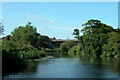
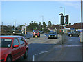
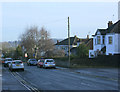
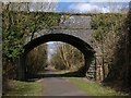

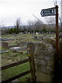
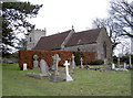
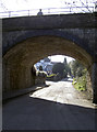
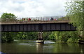
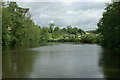
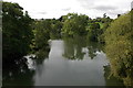
100 photos from this area
Area Information
Key information about the BS31 3EP including its size, population, and administrative classification.
- Area Type
- Postcode
- Area Size
- 12.7 hectares
- Population
- 1413
- Population Density
- 577 people/km²
House Prices in BS31 3EP
13
Properties
£613,571
Average Sold Price
£145,000
Lowest Price
£1,250,000
Highest Price
Showing 13 properties
| Address | Type | Beds | Baths | Last Sale Price | Last Sale Date | |
|---|---|---|---|---|---|---|
| Waterleet, Mead Lane, Saltford, BS31 3EP | Detached | 5 | 3 | £1,250,000 | Feb 2025 | |
| Marlyn, Mead Lane, Saltford, BS31 3EP | Bungalow | - | - | £600,000 | Oct 2021 | |
| Rockside, Mead Lane, Saltford, BS31 3EP | house | - | - | £920,000 | Jun 2021 | |
| River View, Mead Lane, Saltford, BS31 3EP | house | - | - | £640,000 | Aug 2010 | |
| Greenhills, Mead Lane, Saltford, BS31 3EP | Detached | - | - | £350,000 | Oct 2007 | |
| Sheldrake, Mead Lane, Saltford, BS31 3EP | Detached | 4 | 4 | £390,000 | Aug 2003 | |
| Water Row, Mead Lane, Saltford, BS31 3EP | Detached | - | - | £145,000 | Aug 1997 | |
| Kelston View, Mead Lane, Saltford, BS31 3EP | Semi-detached | 3 | 1 | - | - | |
| Avonlea, Mead Lane, Saltford, BS31 3EP | Detached | 5 | 3 | - | - | |
| Cherry Cottage, Mead Lane, Saltford, BS31 3EP | Detached | 4 | - | - | - |
Page 1 of 2
Energy Efficiency in BS31 3EP
Amenities
Schools
| Rank | School | Type | Entry gender | Ages |
|---|
Explore more schools in this area
Go to Schools tabDemographics
Household Size
Two person
most common
Accommodation Type
Houses
most common
Tenure
74
majority
Ethnic Group
White
most common
Religion
N/A
most common
Household Composition
N/A
most common
Age
47
median
Adults (30-64 years)
most common
Household Deprivation
N/A
with no deprivation
NS-SEC
45
in Lower managerial occupations
Explore more demographic insights in this area
Go to Demographics tabPlanning
Planning Constraints
- Flood RiskPremium
- Ramsar Wetland SitesPremium
- Area of Outstanding Natural BeautyPremium
- Protected Nature ReservePremium
- Protected WoodlandPremium