Area Overview for BS31 2WA
Photos of BS31 2WA


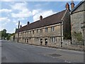
42 photos from this area
Area Information
Key information about the BS31 2WA including its size, population, and administrative classification.
- Area Type
- Postcode
- Area Size
- 6317 m²
- Population
- 2626
- Population Density
- 3017 people/km²
House Prices in BS31 2WA
8
Properties
£365,333
Average Sold Price
£200,000
Lowest Price
£600,000
Highest Price
Showing 8 properties
| Address | Type | Beds | Baths | Last Sale Price | Last Sale Date | |
|---|---|---|---|---|---|---|
| 57 Bristol Road, Keynsham, BS31 2WA | Terraced | 3 | 2 | £365,000 | Mar 2025 | |
| 59 Bristol Road, Keynsham, BS31 2WA | Semi-detached | 3 | 1 | £345,000 | Jun 2024 | |
| 55 Bristol Road, Keynsham, BS31 2WA | house | 4 | 2 | £387,000 | Apr 2022 | |
| 61A Bristol Road, Keynsham, BS31 2WA | Terraced | 3 | 1 | £295,000 | Jan 2021 | |
| 67 Bristol Road, Keynsham, BS31 2WA | Detached | 5 | 3 | £600,000 | Sep 2014 | |
| 61 Bristol Road, Keynsham, BS31 2WA | Terraced | - | - | £200,000 | Aug 2006 | |
| Flat At, Crown Inn, 63 Bristol Road, Keynsham, BS31 2WA | Flat | - | - | - | - | |
| Crown Inn, 63 Bristol Road, Keynsham, BS31 2WA | restaurant_cafe | - | - | - | - |
Energy Efficiency in BS31 2WA
Amenities
Schools
| Rank | School | Type | Entry gender | Ages |
|---|
Explore more schools in this area
Go to Schools tabDemographics
Household Size
Two person
most common
Accommodation Type
Houses
most common
Tenure
68
majority
Ethnic Group
White
most common
Religion
N/A
most common
Household Composition
N/A
most common
Age
47
median
Adults (30-64 years)
most common
Household Deprivation
N/A
with no deprivation
NS-SEC
43
in Lower managerial occupations
Explore more demographic insights in this area
Go to Demographics tabPlanning
Planning Constraints
- Flood RiskPremium
- Ramsar Wetland SitesPremium
- Area of Outstanding Natural BeautyPremium
- Protected Nature ReservePremium
- Protected WoodlandPremium