Area Overview for BS31 1PR
Photos of BS31 1PR
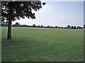
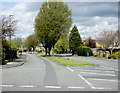
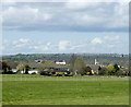
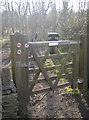
32 photos from this area
Area Information
Key information about the BS31 1PR including its size, population, and administrative classification.
- Area Type
- Postcode
- Area Size
- 9988 m²
- Population
- 1652
- Population Density
- 1209 people/km²
House Prices in BS31 1PR
25
Properties
£241,363
Average Sold Price
£80,000
Lowest Price
£525,000
Highest Price
Showing 25 properties
| Address | Type | Beds | Baths | Last Sale Price | Last Sale Date | |
|---|---|---|---|---|---|---|
| 9 Lambourn Road, Keynsham, BS31 1PR | Flat | 2 | 1 | £153,750 | Jul 2022 | |
| 22 Lambourn Road, Keynsham, BS31 1PR | house | - | - | £450,000 | Mar 2022 | |
| 12 Lambourn Road, Keynsham, BS31 1PR | house | - | - | £525,000 | Jan 2022 | |
| 15 Lambourn Road, Keynsham, BS31 1PR | Semi-detached | 4 | 1 | £460,000 | Feb 2019 | |
| 25 Lambourn Road, Keynsham, BS31 1PR | house | - | - | £370,000 | Dec 2017 | |
| 19 Lambourn Road, Keynsham, BS31 1PR | Semi-detached | 5 | - | £407,000 | Oct 2017 | |
| 10 Lambourn Road, Keynsham, BS31 1PR | Flat | 2 | 1 | £139,000 | Apr 2015 | |
| 8 Lambourn Road, Keynsham, BS31 1PR | Flat | - | - | £146,000 | Dec 2013 | |
| 23 Lambourn Road, Keynsham, BS31 1PR | house | - | - | £303,500 | Dec 2012 | |
| 7 Lambourn Road, Keynsham, BS31 1PR | Flat | 2 | 1 | £104,511 | May 2012 |
Page 1 of 3
Energy Efficiency in BS31 1PR
Amenities
Schools
| Rank | School | Type | Entry gender | Ages |
|---|
Explore more schools in this area
Go to Schools tabDemographics
Household Size
Two person
most common
Accommodation Type
Houses
most common
Tenure
78
majority
Ethnic Group
White
most common
Religion
N/A
most common
Household Composition
N/A
most common
Age
47
median
Adults (30-64 years)
most common
Household Deprivation
N/A
with no deprivation
NS-SEC
42
in Lower managerial occupations
Explore more demographic insights in this area
Go to Demographics tabPlanning
Planning Constraints
- Flood RiskPremium
- Ramsar Wetland SitesPremium
- Area of Outstanding Natural BeautyPremium
- Protected Nature ReservePremium
- Protected WoodlandPremium