Area Overview for BS30 7BX
Photos of BS30 7BX
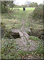
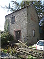
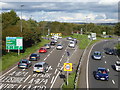
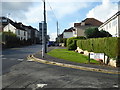

33 photos from this area
Area Information
Key information about the BS30 7BX including its size, population, and administrative classification.
- Area Type
- Postcode
- Area Size
- 3.1 hectares
- Population
- Not available
- Population Density
- Not available
House Prices in BS30 7BX
25
Properties
£256,942
Average Sold Price
£79,950
Lowest Price
£480,000
Highest Price
Showing 25 properties
| Address | Type | Beds | Baths | Last Sale Price | Last Sale Date | |
|---|---|---|---|---|---|---|
| 11 Craven Close, Barrs Court, BS30 7BX | Detached | 4 | 2 | £480,000 | Sep 2024 | |
| 2A Craven Close, Barrs Court, BS30 7BX | Detached | 3 | 2 | £348,000 | Sep 2023 | |
| 25 Craven Close, Barrs Court, BS30 7BX | house | - | - | £411,000 | Oct 2020 | |
| 19 Craven Close, Barrs Court, BS30 7BX | house | - | - | £345,000 | Sep 2020 | |
| 22 Craven Close, Barrs Court, BS30 7BX | Detached | 3 | 1 | £310,000 | Jan 2019 | |
| 17 Craven Close, Barrs Court, BS30 7BX | Detached | 3 | - | £330,000 | Jun 2018 | |
| 1 Craven Close, Barrs Court, BS30 7BX | house | 3 | 2 | £337,500 | Jul 2017 | |
| 2 Craven Close, Barrs Court, BS30 7BX | Detached | 3 | - | £382,500 | Jun 2016 | |
| 8 Craven Close, Barrs Court, BS30 7BX | house | 4 | - | £240,000 | Jan 2013 | |
| 24 Craven Close, Barrs Court, BS30 7BX | house | - | - | £249,995 | Feb 2008 |
Page 1 of 3
Energy Efficiency in BS30 7BX
Amenities
Schools
| Rank | School | Type | Entry gender | Ages |
|---|
Explore more schools in this area
Go to Schools tabDemographics
Household Size
Two person
most common
Accommodation Type
Houses
most common
Tenure
84
majority
Ethnic Group
White
most common
Religion
N/A
most common
Household Composition
N/A
most common
Age
47
median
Adults (30-64 years)
most common
Household Deprivation
N/A
with no deprivation
NS-SEC
33
in Lower managerial occupations
Explore more demographic insights in this area
Go to Demographics tabPlanning
Planning Constraints
- Flood RiskPremium
- Ramsar Wetland SitesPremium
- Area of Outstanding Natural BeautyPremium
- Protected Nature ReservePremium
- Protected WoodlandPremium