Area Overview for BS3 5BE
Photos of BS3 5BE


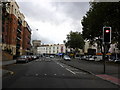


100 photos from this area
Area Information
Key information about the BS3 5BE including its size, population, and administrative classification.
- Area Type
- Postcode
- Area Size
- 2875 m²
- Population
- 2062
- Population Density
- 6966 people/km²
House Prices in BS3 5BE
12
Properties
£198,143
Average Sold Price
£54,500
Lowest Price
£475,000
Highest Price
Showing 12 properties
| Address | Type | Beds | Baths | Last Sale Price | Last Sale Date | |
|---|---|---|---|---|---|---|
| 447 St Johns Lane, Bedminster, Bristol, BS3 5BE | Terraced | 4 | 2 | £475,000 | Jun 2022 | |
| 453 St Johns Lane, Bedminster, Bristol, BS3 5BE | Terraced | 3 | - | £375,000 | Jan 2021 | |
| 443 St Johns Lane, Bedminster, Bristol, BS3 5BE | house | 3 | - | £164,000 | May 2010 | |
| 441 St Johns Lane, Bedminster, Bristol, BS3 5BE | Terraced | 3 | 2 | £155,000 | Dec 2002 | |
| 459A St Johns Lane, Bedminster, Bristol, BS3 5BE | Flat | 1 | 1 | £88,500 | Nov 2002 | |
| 457 St Johns Lane, Bedminster, Bristol, BS3 5BE | house | - | - | £75,000 | Oct 2000 | |
| 445 St Johns Lane, Bedminster, Bristol, BS3 5BE | Terraced | - | - | £54,500 | Nov 1997 | |
| Flat 1, 455 St Johns Lane, Bedminster, Bristol, BS3 5BE | Flat | 2 | 1 | - | - | |
| Flat 2, 455 St Johns Lane, Bedminster, Bristol, BS3 5BE | Maisonette | 2 | 1 | - | - | |
| 449 St Johns Lane, Bedminster, Bristol, BS3 5BE | Terraced | - | - | - | - |
Page 1 of 2
Energy Efficiency in BS3 5BE
Amenities
Schools
| Rank | School | Type | Entry gender | Ages |
|---|
Explore more schools in this area
Go to Schools tabDemographics
Household Size
Two person
most common
Accommodation Type
Houses
most common
Tenure
61
majority
Ethnic Group
White
most common
Religion
N/A
most common
Household Composition
N/A
most common
Age
47
median
Adults (30-64 years)
most common
Household Deprivation
N/A
with no deprivation
NS-SEC
35
in Lower managerial occupations
Explore more demographic insights in this area
Go to Demographics tabPlanning
Planning Constraints
- Flood RiskPremium
- Ramsar Wetland SitesPremium
- Area of Outstanding Natural BeautyPremium
- Protected Nature ReservePremium
- Protected WoodlandPremium