Area Overview for BS3 4NH
Photos of BS3 4NH


Area Information
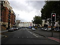
BS3 4NH is a small residential postcode area in Bristol, England, situated on the south side of the River Avon, adjacent to Bedminster. Covering just 2,803 square metres, it is a compact neighbourhood with a population of 1,500 people, resulting in a high population density of 535,047 people per square kilometre. This area is part of the Southville ward, historically shaped by its industrial past, particularly linked to coal mining and tobacco production. The community has a distinct character, influenced by its working-class roots and proximity to Bedminster’s urban infrastructure. Daily life here is defined by its proximity to transport networks, including multiple rail stations and ferry landings, which connect residents to Bristol’s broader economy. The area’s compact size means amenities are tightly clustered, with shops, schools, and transport hubs within walking distance. While its industrial heritage is evident in the architecture, the neighbourhood has evolved into a residential hub with a focus on practical living, though challenges such as safety concerns remain. For buyers, BS3 4NH offers a blend of convenience and historical context, though its small footprint means the housing stock is limited to flats, reflecting a rental-dominated market.
- Area Type
- Postcode
- Area Size
- 2803 m²
- Population
- Not available
- Population Density
- Not available
The property market in BS3 4NH is dominated by rental units, with only 27% of homes owned by residents. This low home ownership rate indicates that the area functions more as a rental market than an owner-occupied one, which may affect long-term investment potential. The accommodation type is exclusively flats, reflecting the area’s high density and compact size. With a total area of just 2,803 square metres, the housing stock is limited, and the small footprint means there is little scope for expansion or new developments. This scarcity of space may drive competition among renters and limit options for buyers seeking larger properties. For those considering purchasing, the prevalence of flats suggests a focus on affordability and proximity to transport, rather than spacious family homes. However, the limited availability of owner-occupied properties may make it challenging for buyers to find a home that suits their needs, particularly if they require more space or a different property type. The market is likely shaped by the area’s historical industrial character and its role as a secondary residential zone near Bristol’s core.
House Prices in BS3 4NH
No properties found in this postcode.
Energy Efficiency in BS3 4NH
Living in BS3 4NH offers access to a range of amenities within practical reach. Retail options include Heron Bedminster, Lidl Bedminster, and Tesco Bedminster, providing everyday shopping needs. The area’s transport links also open up broader opportunities, with rail stations connecting to Bristol’s city centre and beyond, as well as ferry landings that offer scenic routes along the River Avon. For leisure, the proximity to Bristol’s industrial heritage sites and the surrounding urban infrastructure suggests a mix of historical and modern activities. While specific parks or recreational spaces are not detailed in the data, the area’s compact size and transport connectivity imply that residents can easily access green spaces, cultural venues, and other amenities in nearby wards. The presence of multiple airports and metro stations further enhances convenience, supporting both daily commutes and travel. Overall, the lifestyle in BS3 4NH balances practicality with accessibility, though the small footprint means the community is tightly focused on immediate needs rather than expansive leisure options.
Amenities
Schools
The nearest school to BS3 4NH is Holy Cross RC Primary School, a primary school with an Ofsted rating of ‘good’. This institution serves the local community, providing education for younger children within the area. However, the absence of secondary schools or other educational institutions in the immediate vicinity means families may need to look beyond BS3 4NH for secondary education. The presence of a primary school with a positive rating suggests that the area meets basic educational needs, though the lack of higher-level schooling could be a consideration for parents planning for long-term family growth. The school’s ‘good’ rating indicates a satisfactory standard of teaching and facilities, but the limited range of educational options reflects the area’s small size and focus on compact living. For families prioritising proximity to schools, this primary institution is a key asset, but secondary schooling may require travel to nearby wards or districts.
| Rank | School | Type | Entry gender | Ages |
|---|
Explore more schools in this area
Go to Schools tabDemographics
The population of BS3 4NH is predominantly adults aged 30–64, with a median age of 47. This suggests a mature, stable community with a focus on established households rather than young families. Home ownership is low, at just 27%, indicating that the majority of residents are likely to be renters. The area is characterised by flats, which dominate the accommodation type, reflecting a trend common in urban, high-density areas. The predominant ethnic group is White, though specific data on diversity beyond this is not provided. The high population density—over half a million people per square kilometre—suggests a compact, closely knit community, which may influence social dynamics and local services. The age profile and ownership figures imply a population that is largely working-age and possibly reliant on local employment opportunities. This demographic profile may shape the area’s character, with a focus on practical living over family-oriented amenities, though the presence of a primary school suggests some consideration for younger residents.
Household Size
Accommodation Type
Tenure
Ethnic Group
Religion
Household Composition
Age
Household Deprivation
NS-SEC
Explore more demographic insights in this area
Go to Demographics tabPlanning
Planning Constraints
- Flood RiskPremium
- Ramsar Wetland SitesPremium
- Area of Outstanding Natural BeautyPremium
- Protected Nature ReservePremium
- Protected WoodlandPremium