Area Overview for BS3 4AP
Photos of BS3 4AP
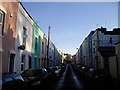
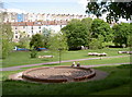
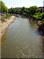
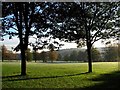

100 photos from this area
Area Information
Key information about the BS3 4AP including its size, population, and administrative classification.
- Area Type
- Postcode
- Area Size
- 2858 m²
- Population
- Not available
- Population Density
- Not available
House Prices in BS3 4AP
79
Properties
£200,966
Average Sold Price
£105,500
Lowest Price
£290,000
Highest Price
Showing 79 properties
| Address | Type | Beds | Baths | Last Sale Price | Last Sale Date | |
|---|---|---|---|---|---|---|
| 57, Doudney Court, William Street, Bedminster, Bristol, BS3 4AP | Flat | 2 | 1 | £260,250 | Aug 2025 | |
| 23, Doudney Court, William Street, Bedminster, Bristol, BS3 4AP | Flat | 2 | 2 | £290,000 | Jul 2025 | |
| 62, Doudney Court, William Street, Bedminster, Bristol, BS3 4AP | Flat | - | - | £279,000 | Mar 2025 | |
| 24, Doudney Court, William Street, Bedminster, Bristol, BS3 4AP | Flat | - | - | £271,750 | Oct 2024 | |
| 11, Doudney Court, William Street, Bedminster, Bristol, BS3 4AP | Flat | - | - | £273,500 | Sep 2024 | |
| 3, Doudney Court, William Street, Bedminster, Bristol, BS3 4AP | Flat | 2 | 2 | £265,000 | Apr 2024 | |
| 16, Doudney Court, William Street, Bedminster, Bristol, BS3 4AP | Flat | - | - | £260,000 | Mar 2024 | |
| 52, Doudney Court, William Street, Bedminster, Bristol, BS3 4AP | Flat | - | - | £280,000 | Mar 2024 | |
| 66, Doudney Court, William Street, Bedminster, Bristol, BS3 4AP | Flat | - | - | £270,000 | Jan 2024 | |
| 29, Doudney Court, William Street, Bedminster, Bristol, BS3 4AP | Flat | - | - | £274,500 | Jan 2024 |
Page 1 of 8
Energy Efficiency in BS3 4AP
Amenities
Schools
| Rank | School | Type | Entry gender | Ages |
|---|
Explore more schools in this area
Go to Schools tabDemographics
Household Size
One person
most common
Accommodation Type
Flats
most common
Tenure
28
majority
Ethnic Group
White
most common
Religion
N/A
most common
Household Composition
N/A
most common
Age
47
median
Adults (30-64 years)
most common
Household Deprivation
N/A
with no deprivation
NS-SEC
45
in Lower managerial occupations
Explore more demographic insights in this area
Go to Demographics tabPlanning
Planning Constraints
- Flood RiskPremium
- Ramsar Wetland SitesPremium
- Area of Outstanding Natural BeautyPremium
- Protected Nature ReservePremium
- Protected WoodlandPremium