Area Overview for BS3 2HN
Photos of BS3 2HN


Area Information
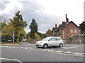
BS3 2HN is a small residential postcode area in the southern suburb of Bedminster, historically part of Somerset before its integration into Bristol. With a population of 2131, it reflects a tight-knit community centred on its Roman-era origins, particularly East and West Streets. The area’s character is shaped by its proximity to the River Avon and the New Cut, a 19th-century engineering feat that redefined local transport. Daily life here balances suburban tranquillity with access to urban amenities, including nearby railway stations, ferry landings, and retail hubs. The presence of Ashton Vale Primary School, rated ‘good’ by Ofsted, underscores the area’s appeal to families. While historically marked by industrial activity, such as shipbuilding in the 19th century, modern BS3 2HN is defined by its modest housing stock and practical connectivity. Its compact size means residents are close to both natural features like the River Malago and the city’s infrastructure, making it a pragmatic choice for those seeking a blend of accessibility and local charm.
- Area Type
- Postcode
- Area Size
- Not available
- Population
- Not available
- Population Density
- Not available
BS3 2HN is predominantly an owner-occupied area, with 66% of homes owned by residents rather than rented. The accommodation type is largely houses, which is unusual for urban postcodes and suggests a focus on family homes or multi-generational living. This housing stock implies a market where buyers can expect established properties with potential for long-term value. The small size of the area means the property market is limited to a tight cluster of homes, with little scope for new developments. For buyers, this translates to a need to consider immediate surroundings for additional options. The prevalence of houses also indicates a community prioritising private space over high-density living, which may appeal to those seeking a quieter, more settled environment. However, the limited number of properties means competition could be keen among buyers.
House Prices in BS3 2HN
No properties found in this postcode.
Energy Efficiency in BS3 2HN
Residents of BS3 2HN have access to a range of practical amenities within easy reach. Five retail outlets, including Iceland, Sainsburys, and Aldi, provide everyday shopping needs, while three ferry landings and five railway stations ensure smooth travel. The proximity to Bristol Airport and Filton Airport adds convenience for those reliant on air travel. Though the area lacks large leisure facilities, its compact size means residents are close to the River Avon and historical sites like the New Cut, offering recreational opportunities. The presence of multiple transport options and retail choices enhances daily convenience, supporting a lifestyle that balances suburban comfort with urban accessibility. The area’s amenities, while modest, are sufficient for most household needs, making it a pragmatic choice for those prioritising practicality over luxury.
Amenities
Schools
The nearest school to BS3 2HN is Ashton Vale Primary School, a primary school rated ‘good’ by Ofsted. This rating reflects satisfactory standards in teaching, pupil progress, and leadership, though it is not outstanding. The presence of a single primary school suggests that families in the area may need to consider secondary education options further afield. The school’s proximity to the postcode makes it a practical choice for younger children, reducing commuting times for parents. However, the absence of secondary schools within the immediate vicinity means families should investigate local secondary institutions when planning for older children. The school’s rating, while not the highest, indicates a baseline of quality that aligns with the area’s overall practicality and stability.
| Rank | School | Type | Entry gender | Ages |
|---|
Explore more schools in this area
Go to Schools tabDemographics
The population of BS3 2HN has a median age of 47, with the majority of residents aged between 30 and 64 years. This suggests a mature, stable community with a focus on long-term residency. Home ownership is high, at 66%, indicating a strong presence of owner-occupied properties, predominantly houses. The area’s predominant ethnic group is White, reflecting its historical roots and limited demographic diversity. The absence of specific data on deprivation or other socioeconomic factors means the area’s quality of life is inferred from its infrastructure and amenities. The age profile suggests a balance between working-age adults and retirees, with households likely prioritising comfort and security. This demographic mix supports a community that values established living environments over rapid change, aligning with the area’s historical and architectural continuity.
Household Size
Accommodation Type
Tenure
Ethnic Group
Religion
Household Composition
Age
Household Deprivation
NS-SEC
Explore more demographic insights in this area
Go to Demographics tabPlanning
Planning Constraints
- Flood RiskPremium
- Ramsar Wetland SitesPremium
- Area of Outstanding Natural BeautyPremium
- Protected Nature ReservePremium
- Protected WoodlandPremium