Area Overview for BS3 2AZ
Photos of BS3 2AZ


Area Information
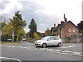
BS3 2AZ is a compact residential postcode in Bristol’s southern suburbs, encompassing just 5.5 hectares yet home to 2,131 people. Its high population density—39,078 people per square kilometre—reflects a tightly knit community, though the area’s small size means every resident shares proximity to local amenities and historical landmarks. Historically part of Somerset until the 19th century, Bedminster, where BS3 2AZ lies, has roots stretching back to Roman times, with East and West Streets forming its original heart. Today, it balances modern living with heritage, including the New Cut of the River Avon, dug in 1809. The area’s mix of houses and proximity to transport links make it appealing for commuters, though its limited space means every home is close to neighbours. For those seeking a blend of history and convenience, BS3 2AZ offers a distinct character shaped by its past and present.
- Area Type
- Postcode
- Area Size
- 5.5 hectares
- Population
- Not available
- Population Density
- Not available
BS3 2AZ is primarily an owner-occupied area, with 66% of homes owned by residents rather than rented. The accommodation type is predominantly houses, which is notable given the area’s small size and high density. This suggests homes are likely to be smaller or in terraced layouts, catering to families or individuals seeking private living spaces. The limited land area means the housing stock is finite, so buyers should consider nearby areas for more options. The high home ownership rate indicates stability, but the compact nature of the postcode may mean competition for properties. For those prioritising proximity to amenities and transport, BS3 2AZ’s houses offer a balance of space and convenience within a tightly woven neighbourhood.
House Prices in BS3 2AZ
Showing 1 properties
| Address | Type | Beds | Baths | Last Sale Price | Last Sale Date | |
|---|---|---|---|---|---|---|
| Manheim Auctions, 33 Ashton Vale Road, Ashton, Bristol, BS3 2AZ | commercial | - | - | - | - |
Energy Efficiency in BS3 2AZ
Residents of BS3 2AZ have access to a range of nearby amenities, including five retail outlets such as Iceland South Bristol Retail, Sainsburys Winterstoke, and Aldi Southville, ensuring everyday shopping needs are met. The area’s proximity to rail stations, ferries, and airports enhances its connectivity, supporting both leisure and commuting. While specific parks or recreational spaces are not listed, historical sites like the New Cut of the River Avon and the Roman-era streets of East and West Street add cultural value. The compact layout means amenities are within walking or short driving distance, fostering a convenient lifestyle. However, the limited land area means residents must balance proximity to services with the area’s density, which could influence the overall character of daily life.
Amenities
Schools
The nearest school to BS3 2AZ is Ashton Vale Primary School, which has an Ofsted rating of ‘good’. This primary school serves the local community, offering education for younger children. The absence of secondary schools in the immediate area means families may need to look further afield for secondary education, though the primary school’s rating suggests a solid foundation for early learning. The presence of a single primary school reflects the area’s small size, but its quality rating indicates it meets acceptable standards for local needs. For families prioritising proximity to schools, Ashton Vale Primary School is a key asset, though additional research would be needed for secondary options.
| Rank | School | Type | Entry gender | Ages |
|---|
Explore more schools in this area
Go to Schools tabDemographics
The median age in BS3 2AZ is 47, with the majority of residents aged 30–64, indicating a mature, stable population. Home ownership rates are high at 66%, with houses the predominant accommodation type. This suggests a community of long-term residents rather than transient renters. The predominant ethnic group is White, though no specific data on diversity or deprivation levels is provided. The high population density—39,078 people per square kilometre—means the area is intensely populated for its size, which could influence local services and social dynamics. While no figures on income or deprivation are available, the mix of homeownership and family households implies a focus on settled, family-oriented living.
Household Size
Accommodation Type
Tenure
Ethnic Group
Religion
Household Composition
Age
Household Deprivation
NS-SEC
Explore more demographic insights in this area
Go to Demographics tabPlanning
Planning Constraints
- Flood RiskPremium
- Ramsar Wetland SitesPremium
- Area of Outstanding Natural BeautyPremium
- Protected Nature ReservePremium
- Protected WoodlandPremium