Area Overview for BS3 1EW
Photos of BS3 1EW


Area Information
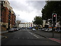
BS3 1EW constitutes a specific residential cluster within the larger community of Bedminster in Bristol. This small area covers just 766 square metres yet supports a population of 1,298 people. It sits south of the River Avon, part of a historically significant suburb that originated as a Roman rural farmstead centred on East Street and West Street. The location inherits a deep history, first mentioned as a manor in the Domesday Book of 1086 and later sacked by Prince Rupert in 1644 during the English Civil War. Today, the postcode serves as a gateway to a suburb with centuries of industrial and residential layers, including former shipbuilding yards and a workhouse built in the late 19th century. Daily life here integrates modern urban convenience with the area's Roman origins and historical streets. Residents benefit from proximity to the River Malago and the New Cut, which was dug in 1809. Living in BS3 1EW means being situated in a neighbourhood that balances its past as a decayed market town with its current role as an integrated part of Bristol. The compact nature of the postcode suggests a close-knit environment where homes are clustered efficiently on a limited landmass.
- Area Type
- Postcode
- Area Size
- 766 m²
- Population
- Not available
- Population Density
- Not available
The property market in BS3 1EW is characterised by a specific type of housing stock defined largely by its flat-based layout. Flats are the predominant accommodation type, a feature that makes sense given the area's status as a small residential cluster covering only 766 square metres. Ownership levels provide further context, with home ownership recorded at 41 per cent. This relatively high percentage indicates that a substantial number of properties are bought with the intention of long-term residence rather than purely for speculative investment or short-term letting. For buyers looking at this postcode, the market offers a high density of multi-unit living within a tight geographical boundaries. The dominance of flats suggests a need for efficient use of space, reflecting the limited land available for development. Potential purchasers should expect a environment where vertical living is common. The presence of a significant owner-occupied base suggests a degree of stability within the streets, even while the area continues to evolve as part of the larger Bedminster community. Understanding this mix is key when evaluating homes in BS3 1EW.
House Prices in BS3 1EW
No properties found in this postcode.
Energy Efficiency in BS3 1EW
Living in BS3 1EW offers immediate access to a wide range of shopping, transport, and leisure facilities. You have five retail options nearby, including Tesco Bedminster, Heron Bedminster, and Lidl Bedminster, which handle daily grocery and shopping needs conveniently. Retail diversity ensures you do not need to travel far for essentials. Transport connectivity is exceptional, with five railway stations, five ferry landing points, and two airports accessible within a short distance. Bedminster Railway Station and Parson Street Railway Station are key hubs, while Wapping Wharf and the Millennium Square Ferry Landing provide waterway links. For cleaner transport, two metro routes operate through Bitton and Oldland, linking the area to wider networks. These five rail stations and multiple ferry points mean you can choose the travel mode that suits your daily routine best. The map of London Transport in the source data mentions a stunning city centre, which serves as a major employer nearby. While the specific areas are south of the River Avon, the proximity to East Street and West Street anchors you in a place with deep historical roots. This access to five distinct ferry landing points and multiple railway stations makes daily life in BS3 1EW surprisingly well-connected for a postcode of its size.
Amenities
Schools
| Rank | School | Type | Entry gender | Ages |
|---|
Explore more schools in this area
Go to Schools tabDemographics
The community in BS3 1EW has a distinct profile, with a median age of 47 years. The most common age range for residents falls between 30 and 64 years, indicating a population dominated by adults establishing families or stabilising their careers. This demographic skew means you are likely to encounter a mature, settled neighbourhood rather than one filled with young children or students. Home ownership stands at 41 per cent, meaning a significant portion of households are landlords purchasing rental properties rather than owner-occupiers. This statistic is high compared to many other parts of the country and points to a complex mix of residents. The accommodation type data shows that flats predominate in this specific cluster, which aligns with the compact area size of 766 square metres. The predominant ethnic group is White, reflecting the broader makeup of Southern Bristol. Understanding these demographics helps you gauge the social fabric of homes in BS3 1EW. The high concentration of adults and the prevalence of flats suggest an area suited for those seeking established housing stock in a convenient location.
Household Size
Accommodation Type
Tenure
Ethnic Group
Religion
Household Composition
Age
Household Deprivation
NS-SEC
Explore more demographic insights in this area
Go to Demographics tabPlanning
Planning Constraints
- Flood RiskPremium
- Ramsar Wetland SitesPremium
- Area of Outstanding Natural BeautyPremium
- Protected Nature ReservePremium
- Protected WoodlandPremium