Area Overview for BS3 1DD
Photos of BS3 1DD


Area Information
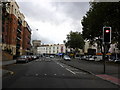
Southville is a ward in Bristol, England, located on the south side of the River Avon, just northwest of the neighbouring area known as Bedminster. This specific postcode area, BS3 1DD, covers a small residential cluster measuring 2,940 square metres that accommodates a population of 1,964 people. The density here is significant, with 667,960 people per square kilometre according to the recorded figures for this region. The area developed primarily during the late 19th and early 20th centuries when houses were built to accommodate workers in Bristol's coal mining industry and tobacco factories. Imperial Tobacco maintained a significant presence with its main office located in the ward, shaping the local employment landscape during the area's formative period. This industrial heritage continues to define the neighbourhood's character. Modern political history is notable for electing Bristol's first Green councillor in 2006, with Green representation continuing thereafter. Today, you live in a lively urban area where the residential character remains shaped by its history of extractive industries and manufacturing. The community sits at the administrative boundary within Bristol City Council's structure. While the two areas are geographically adjacent, Southville is considered a distinct neighbourhood from Bedminster. You are exploring homes in a zone with deep historical roots that have evolved into a working-class community with a defined identity. The small footprint of the postcode area means a strong sense of locality, yet the area remains part of the broader urban fabric of Bristol.
- Area Type
- Postcode
- Area Size
- 2940 m²
- Population
- Not available
- Population Density
- Not available
The property market in BS3 1DD is characterised by a significant proportion of owner-occupiers, with home ownership standing at 60 per cent. This indicates a stable market where a majority of households have a stake in the property rather than renting. The predominant accommodation type is houses, which defines the physical landscape of this small residential cluster. Given that the area covers just 2,940 square metres, the housing stock is likely compact yet sufficient for the local population of 1,964 people. You are looking at an area where the majority of residents buy rather than rent, which often signals a community with entrenched families. The fact that houses are the main accommodation type means you will not find a prevalence of high-density flats in this specific postcode. This aligns with the historical context where the ward developed to accommodate workers in the coal mining industry and tobacco factories. The 60 per cent ownership rate suggests that many residents have lived here for a considerable time. When exploring homes in BS3 1DD, you should expect a market dominated by family houses. This contrasts with areas where rental properties might be the primary option. The data confirms that this is largely a market for buyers seeking to settle down. The accommodation type distribution offers a clear picture of the neighbourhood's character without the noise of a transient rental sector.
House Prices in BS3 1DD
Showing 15 properties
| Address | Type | Beds | Baths | Last Sale Price | Last Sale Date | |
|---|---|---|---|---|---|---|
| 20A Dean Lane, Southville, Bristol, BS3 1DD | Flat | 4 | 1 | £350,000 | Jun 2025 | |
| 26 Dean Lane, Southville, Bristol, BS3 1DD | Terraced | 3 | 1 | £348,000 | Sep 2023 | |
| 16 Dean Lane, Southville, Bristol, BS3 1DD | Terraced | 2 | 1 | £195,000 | Oct 2007 | |
| 14 Dean Lane, Southville, Bristol, BS3 1DD | Terraced | - | - | £216,000 | May 2006 | |
| 12 Dean Lane, Southville, Bristol, BS3 1DD | Terraced | 4 | - | £190,000 | Mar 2005 | |
| 3 Dean Lane, Southville, Bristol, BS3 1DD | Flat | 1 | 1 | £217,500 | Nov 2002 | |
| 24 Dean Lane, Southville, Bristol, BS3 1DD | Terraced | - | - | £121,000 | Mar 2000 | |
| 30 Dean Lane, Southville, Bristol, BS3 1DD | Semi-detached | - | - | - | - | |
| 20 Dean Lane, Southville, Bristol, BS3 1DD | Terraced | 4 | 4 | - | - | |
| First Floor Flat, 22 Dean Lane, Southville, Bristol, BS3 1DD | Flat | 3 | 2 | - | - |
Energy Efficiency in BS3 1DD
Residents of BS3 1DD enjoy convenient access to a range of amenities within practical reach. For retail needs, you are close to Heron Bedminster, Asda Bedminster, and Tesco Canons. These five notable retail locations cover most everyday shopping requirements. The area also benefits from excellent transport links, with five notable ferry landings including Millennium Square Ferry Landing, Wapping Wharf, and Prince Street Bridge Ferry Landing. Here you are for five nearby rail options featuring Bedminster Railway Station, Parson Street Railway Station, and Bristol Temple Meads Railway Station. Transport choices extend further with one airport option at Bristol Filton Airport and two metro stops at Bitton and Oldland. This diverse mix of private transport, public rail, and maritime access connects you to wider Bristol and beyond. The presence of these five ferry services highlights the area's accessibility along the River Avon. You can reach dining and essential services without needing to travel far. The lively urban character ensures that daily needs are met with minimal effort. Whether you require groceries, catch a train, or explore nearby leisure spots, the amenity density supports a convenient lifestyle. Living in BS3 1DD means having these key facilities immediately accessible, which enhances the day-to-day experience for all residents.
Amenities
Schools
Families considering BS3 1DD have access to specific educational institutions that serve the local community. Southville Primary School is located nearby, offering primary education to young children in the ward. The school holds a good Ofsted rating, which represents a positive assessment of the educational quality provided. As this is the only school listed in the immediate vicinity for this specific analysis, parents should rely on this institution for the early years of their children's education. You will not find secondary schools listed in the immediate proximity data for this postcode. This means that once children reach secondary school age, families in BS3 1DD will need to look further afield for high school education. The presence of a good-rated primary school supports families with younger children looking for quality education within the area. The school mix consists solely of primary provision based on the available facts, so your options for secondary education lie beyond the immediate neighbourhood boundaries. Southville Primary School remains a key feature for those living in this ward, providing a bedrock for early learning. When evaluating homes in BS3 1DD, proximity to this rated primary school is a confirmed advantage for families with primary-aged children.
| Rank | School | Type | Entry gender | Ages |
|---|
Explore more schools in this area
Go to Schools tabDemographics
The community in BS3 1DD reflects a mature demographic profile. The median age is 47 years, and the most common age range for residents is adults between 30 and 64 years. This age distribution indicates an area where families or established professionals form the core of the population. Home ownership stands at 60 per cent, meaning a solid majority of households own their properties outright or with a mortgage. The predominant accommodation type is houses, which aligns with the broader historical development of the ward. Ethnically, the predominant group is White, reflecting the established nature of the settlement. With a population of 1,964 within this specific 2,940 square metre zone, the community is relatively compact. The high population density figure suggests that while the total number of residents is low, the land use is efficient for a residential cluster. You will find a community that has stood the test of time, with adults dominating the age bracket. This stability often correlates with long-term residents who have been in the area for many years. The demographic data paints a picture of a settled community where the majority of people are in the middle years of adulthood. This concentration of age groups suggests a neighbourhood suited to those seeking stability rather than transient living arrangements.
Household Size
Accommodation Type
Tenure
Ethnic Group
Religion
Household Composition
Age
Household Deprivation
NS-SEC
Explore more demographic insights in this area
Go to Demographics tabPlanning
Planning Constraints
- Flood RiskPremium
- Ramsar Wetland SitesPremium
- Area of Outstanding Natural BeautyPremium
- Protected Nature ReservePremium
- Protected WoodlandPremium