Area Overview for BS28 4SR
Photos of BS28 4SR

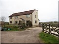
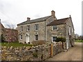
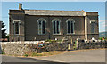
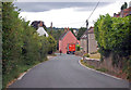
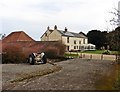
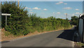
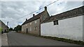
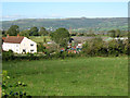
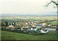
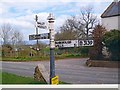
11 photos from this area
Area Information
Key information about the BS28 4SR including its size, population, and administrative classification.
- Area Type
- Postcode
- Area Size
- 18.6 hectares
- Population
- 1718
- Population Density
- 60 people/km²
House Prices in BS28 4SR
22
Properties
£321,893
Average Sold Price
£94,000
Lowest Price
£795,000
Highest Price
Showing 22 properties
| Address | Type | Beds | Baths | Last Sale Price | Last Sale Date | |
|---|---|---|---|---|---|---|
| Poachers Pocket, Wells Road, Theale, Wedmore, BS28 4SR | house | 2 | 1 | £214,500 | Apr 2017 | |
| White Willows, Wells Road, Theale, Wedmore, BS28 4SR | Bungalow | - | - | £340,000 | Sep 2016 | |
| The Coach House, Wells Road, Theale, Wedmore, BS28 4SR | house | 3 | - | £500,000 | Feb 2015 | |
| Ridgefield, Wells Road, Theale, Wedmore, BS28 4SR | Detached | 6 | 2 | £249,000 | Feb 2014 | |
| Hawthorns, Wells Road, Theale, Wedmore, BS28 4SR | house | 2 | - | £176,000 | Sep 2013 | |
| Northleigh, Wells Road, Theale, Wedmore, BS28 4SR | house | 6 | - | £735,000 | Aug 2013 | |
| Woodpecker View, Wells Road, Theale, Wedmore, BS28 4SR | Bungalow | 3 | - | £290,000 | Jan 2011 | |
| Col-drey, Wells Road, Theale, Wedmore, BS28 4SR | Bungalow | - | - | £225,000 | Dec 2009 | |
| Pear Tree Cottage, Wells Road, Theale, Wedmore, BS28 4SR | Detached | - | - | £325,000 | Apr 2008 | |
| The Old Vicarage, Wells Road, Theale, Wedmore, BS28 4SR | Detached | - | - | £795,000 | Sep 2007 |
Page 1 of 3
Energy Efficiency in BS28 4SR
Amenities
Schools
| Rank | School | Type | Entry gender | Ages |
|---|
Explore more schools in this area
Go to Schools tabDemographics
Household Size
Two person
most common
Accommodation Type
Houses
most common
Tenure
89
majority
Ethnic Group
White
most common
Religion
N/A
most common
Household Composition
N/A
most common
Age
47
median
Adults (30-64 years)
most common
Household Deprivation
N/A
with no deprivation
NS-SEC
45
in Lower managerial occupations
Explore more demographic insights in this area
Go to Demographics tabPlanning
Planning Constraints
- Flood RiskPremium
- Ramsar Wetland SitesPremium
- Area of Outstanding Natural BeautyPremium
- Protected Nature ReservePremium
- Protected WoodlandPremium