Area Overview for BS26 2TG
Photos of BS26 2TG

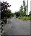
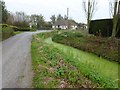
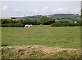
43 photos from this area
Area Information
Key information about the BS26 2TG including its size, population, and administrative classification.
- Area Type
- Postcode
- Area Size
- 7.4 hectares
- Population
- 2328
- Population Density
- 96 people/km²
House Prices in BS26 2TG
12
Properties
£262,000
Average Sold Price
£120,000
Lowest Price
£608,000
Highest Price
Showing 12 properties
| Address | Type | Beds | Baths | Last Sale Price | Last Sale Date | |
|---|---|---|---|---|---|---|
| Peplow, Bristol Road, Rooksbridge, Axbridge, BS26 2TG | house | 4 | - | £120,000 | Jul 2013 | |
| Grove Cottage, Bristol Road, Rooksbridge, Axbridge, BS26 2TG | Semi-detached | 2 | 1 | £160,000 | May 2010 | |
| The Old Manor, Bristol Road, Rooksbridge, Axbridge, BS26 2TG | Detached | - | - | £608,000 | May 2007 | |
| Dos A Qui, Bristol Road, Rooksbridge, Axbridge, BS26 2TG | Detached | 3 | 2 | £160,000 | Aug 2006 | |
| 2, Farm Cottage, Bristol Road, Rooksbridge, Axbridge, BS26 2TG | Semi-detached | 3 | - | - | - | |
| 2 Bristol Road, Rooksbridge, Axbridge, BS26 2TG | undefined | - | - | - | - | |
| The Cottages, Bristol Road, Rooksbridge, Axbridge, BS26 2TG | Semi-detached | - | - | - | - | |
| The Wagon House, Bristol Road, Rooksbridge, Axbridge, BS26 2TG | house | - | - | - | - | |
| Orchard Barns, Bristol Road, Rooksbridge, Axbridge, BS26 2TG | house | - | - | - | - | |
| Keepers Cottage, Bristol Road, Rooksbridge, Axbridge, BS26 2TG | Terraced | - | - | - | - |
Page 1 of 2
Energy Efficiency in BS26 2TG
Amenities
Schools
| Rank | School | Type | Entry gender | Ages |
|---|
Explore more schools in this area
Go to Schools tabDemographics
Household Size
Two person
most common
Accommodation Type
Houses
most common
Tenure
81
majority
Ethnic Group
White
most common
Religion
N/A
most common
Household Composition
N/A
most common
Age
47
median
Adults (30-64 years)
most common
Household Deprivation
N/A
with no deprivation
NS-SEC
37
in Lower managerial occupations
Explore more demographic insights in this area
Go to Demographics tabPlanning
Planning Constraints
- Flood RiskPremium
- Ramsar Wetland SitesPremium
- Area of Outstanding Natural BeautyPremium
- Protected Nature ReservePremium
- Protected WoodlandPremium