Area Overview for BS26 2JW
Photos of BS26 2JW
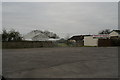
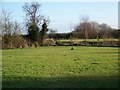
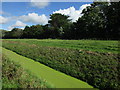
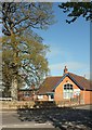
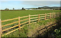
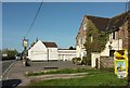
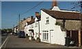
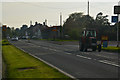
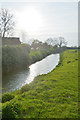
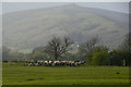
41 photos from this area
Area Information
Key information about the BS26 2JW including its size, population, and administrative classification.
- Area Type
- Postcode
- Area Size
- 20.4 hectares
- Population
- 2226
- Population Density
- 74 people/km²
House Prices in BS26 2JW
13
Properties
£251,389
Average Sold Price
£94,500
Lowest Price
£420,000
Highest Price
Showing 13 properties
| Address | Type | Beds | Baths | Last Sale Price | Last Sale Date | |
|---|---|---|---|---|---|---|
| 3 East End, Lower Weare, Axbridge, BS26 2JW | house | - | - | £390,000 | Oct 2023 | |
| 6 East End, Lower Weare, Axbridge, BS26 2JW | house | - | - | £250,000 | Jan 2023 | |
| 2 East End, Lower Weare, Axbridge, BS26 2JW | house | 3 | 1 | £300,000 | Jul 2022 | |
| Loxtons Cottage, Notting Hill Way, Lower Weare, Axbridge, BS26 2JW | Detached | 4 | 1 | £315,000 | Mar 2019 | |
| Honeyfield House, Notting Hill Way, Lower Weare, Axbridge, BS26 2JW | house | 4 | - | £420,000 | Oct 2012 | |
| 4 East End, Lower Weare, Axbridge, BS26 2JW | house | 4 | - | £195,000 | Nov 2010 | |
| Elm Tree Farm, Notting Hill Way, Lower Weare, Axbridge, BS26 2JW | house | - | - | £160,000 | Jul 1997 | |
| Myrtle House, Notting Hill Way, Lower Weare, Axbridge, BS26 2JW | Detached | - | - | £138,000 | Apr 1997 | |
| Maple Cottage, Notting Hill Way, Lower Weare, Axbridge, BS26 2JW | house | - | - | £94,500 | Sep 1996 | |
| Briars House, Notting Hill Way, Lower Weare, Axbridge, BS26 2JW | house | 6 | - | - | - |
Page 1 of 2
Energy Efficiency in BS26 2JW
Amenities
Schools
| Rank | School | Type | Entry gender | Ages |
|---|
Explore more schools in this area
Go to Schools tabDemographics
Household Size
Two person
most common
Accommodation Type
Houses
most common
Tenure
87
majority
Ethnic Group
White
most common
Religion
N/A
most common
Household Composition
N/A
most common
Age
47
median
Adults (30-64 years)
most common
Household Deprivation
N/A
with no deprivation
NS-SEC
45
in Lower managerial occupations
Explore more demographic insights in this area
Go to Demographics tabPlanning
Planning Constraints
- Flood RiskPremium
- Ramsar Wetland SitesPremium
- Area of Outstanding Natural BeautyPremium
- Protected Nature ReservePremium
- Protected WoodlandPremium