Area Overview for BS24 9QL
Photos of BS24 9QL
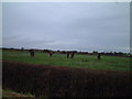
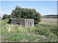
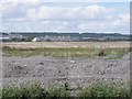
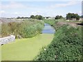
4 photos from this area
Area Information
Key information about the BS24 9QL including its size, population, and administrative classification.
- Area Type
- Postcode
- Area Size
- 2.0 hectares
- Population
- 1347
- Population Density
- 1220 people/km²
House Prices in BS24 9QL
14
Properties
£216,564
Average Sold Price
£89,000
Lowest Price
£315,000
Highest Price
Showing 14 properties
| Address | Type | Beds | Baths | Last Sale Price | Last Sale Date | |
|---|---|---|---|---|---|---|
| 21 Moor Lane, Hutton, BS24 9QL | house | - | - | £315,000 | Mar 2023 | |
| 27 Moor Lane, Hutton, BS24 9QL | Detached | 3 | 3 | £245,000 | Dec 2020 | |
| 33 Moor Lane, Hutton, BS24 9QL | house | - | - | £219,950 | Sep 2014 | |
| 35 Moor Lane, Hutton, BS24 9QL | Semi-detached | 4 | 2 | £210,000 | Oct 2013 | |
| 39 Moor Lane, Hutton, BS24 9QL | house | - | - | £237,000 | Apr 2010 | |
| 41 Moor Lane, Hutton, BS24 9QL | house | - | - | £200,000 | Sep 2005 | |
| 37 Moor Lane, Hutton, BS24 9QL | Detached | - | - | £89,000 | Jun 1999 | |
| 18 Moor Lane, Hutton, BS24 9QL | Bungalow | 3 | - | - | - | |
| 23 Moor Lane, Hutton, BS24 9QL | Land | - | - | - | - | |
| 29 Moor Lane, Hutton, BS24 9QL | Flat | - | - | - | - |
Page 1 of 2
Energy Efficiency in BS24 9QL
Amenities
Schools
| Rank | School | Type | Entry gender | Ages |
|---|
Explore more schools in this area
Go to Schools tabDemographics
Household Size
Two person
most common
Accommodation Type
Houses
most common
Tenure
90
majority
Ethnic Group
White
most common
Religion
N/A
most common
Household Composition
N/A
most common
Age
47
median
Elderly (65+ years)
most common
Household Deprivation
N/A
with no deprivation
NS-SEC
32
in Lower managerial occupations
Explore more demographic insights in this area
Go to Demographics tabPlanning
Planning Constraints
- Flood RiskPremium
- Ramsar Wetland SitesPremium
- Area of Outstanding Natural BeautyPremium
- Protected Nature ReservePremium
- Protected WoodlandPremium