Area Overview for BS24 8DU
Photos of BS24 8DU


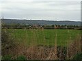


47 photos from this area
Area Information
Key information about the BS24 8DU including its size, population, and administrative classification.
- Area Type
- Postcode
- Area Size
- 1.2 hectares
- Population
- 1347
- Population Density
- 1220 people/km²
House Prices in BS24 8DU
30
Properties
£191,759
Average Sold Price
£57,000
Lowest Price
£357,500
Highest Price
Showing 30 properties
| Address | Type | Beds | Baths | Last Sale Price | Last Sale Date | |
|---|---|---|---|---|---|---|
| 10 The Orchard, Locking, BS24 8DU | Detached | 3 | 1 | £280,000 | Sep 2025 | |
| 18 The Orchard, Locking, BS24 8DU | house | - | - | £200,000 | Feb 2024 | |
| 11 The Orchard, Locking, BS24 8DU | Semi-detached | 4 | 2 | £357,500 | Sep 2023 | |
| 19 The Orchard, Locking, BS24 8DU | house | - | - | £277,000 | Jun 2021 | |
| 14 The Orchard, Locking, BS24 8DU | Semi-detached | 3 | 1 | £235,000 | Oct 2019 | |
| 5 The Orchard, Locking, BS24 8DU | Semi-detached | 3 | 1 | £285,000 | Sep 2019 | |
| 15 The Orchard, Locking, BS24 8DU | Semi-detached | 3 | 1 | £223,000 | Apr 2019 | |
| 12 The Orchard, Locking, BS24 8DU | Semi-detached | 3 | 1 | £227,500 | Jan 2019 | |
| 35 The Orchard, Locking, BS24 8DU | Semi-detached | 3 | 2 | £244,950 | Mar 2018 | |
| 17 The Orchard, Locking, BS24 8DU | Semi-detached | 3 | - | £242,500 | Mar 2018 |
Page 1 of 3
Energy Efficiency in BS24 8DU
Amenities
Schools
| Rank | School | Type | Entry gender | Ages |
|---|
Explore more schools in this area
Go to Schools tabDemographics
Household Size
Two person
most common
Accommodation Type
Houses
most common
Tenure
90
majority
Ethnic Group
White
most common
Religion
N/A
most common
Household Composition
N/A
most common
Age
47
median
Elderly (65+ years)
most common
Household Deprivation
N/A
with no deprivation
NS-SEC
32
in Lower managerial occupations
Explore more demographic insights in this area
Go to Demographics tabPlanning
Planning Constraints
- Flood RiskPremium
- Ramsar Wetland SitesPremium
- Area of Outstanding Natural BeautyPremium
- Protected Nature ReservePremium
- Protected WoodlandPremium