Area Overview for BS24 7GD
Photos of BS24 7GD


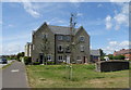
24 photos from this area
Area Information
Key information about the BS24 7GD including its size, population, and administrative classification.
- Area Type
- Postcode
- Area Size
- 3908 m²
- Population
- Not available
- Population Density
- Not available
House Prices in BS24 7GD
16
Properties
£204,500
Average Sold Price
£138,000
Lowest Price
£285,000
Highest Price
Showing 16 properties
| Address | Type | Beds | Baths | Last Sale Price | Last Sale Date | |
|---|---|---|---|---|---|---|
| 11 Buckle Path, West Wick, BS24 7GD | house | - | - | £285,000 | Jun 2023 | |
| 3 Buckle Path, West Wick, BS24 7GD | house | - | - | £240,000 | Dec 2021 | |
| 14 Buckle Path, West Wick, BS24 7GD | house | 3 | 3 | £237,000 | May 2021 | |
| 16 Buckle Path, West Wick, BS24 7GD | house | - | - | £212,000 | Feb 2021 | |
| 12 Buckle Path, West Wick, BS24 7GD | house | - | - | £222,500 | Jun 2020 | |
| 10 Buckle Path, West Wick, BS24 7GD | Semi-detached | 3 | 2 | £218,000 | Mar 2020 | |
| 8 Buckle Path, West Wick, BS24 7GD | Semi-detached | 2 | - | £185,000 | May 2018 | |
| 7 Buckle Path, West Wick, BS24 7GD | house | - | - | £202,000 | Oct 2015 | |
| 5 Buckle Path, West Wick, BS24 7GD | house | - | - | £138,000 | May 2013 | |
| 9 Buckle Path, West Wick, BS24 7GD | Terraced | 3 | 2 | £163,000 | Feb 2013 |
Page 1 of 2
Energy Efficiency in BS24 7GD
Amenities
Schools
| Rank | School | Type | Entry gender | Ages |
|---|
Explore more schools in this area
Go to Schools tabDemographics
Household Size
Family (3-5 people)
most common
Accommodation Type
Houses
most common
Tenure
76
majority
Ethnic Group
White
most common
Religion
N/A
most common
Household Composition
N/A
most common
Age
47
median
Adults (30-64 years)
most common
Household Deprivation
N/A
with no deprivation
NS-SEC
38
in Lower managerial occupations
Explore more demographic insights in this area
Go to Demographics tabPlanning
Planning Constraints
- Flood RiskPremium
- Ramsar Wetland SitesPremium
- Area of Outstanding Natural BeautyPremium
- Protected Nature ReservePremium
- Protected WoodlandPremium